Sint Maarten (North Holland)
 flag |
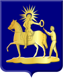
 coat of arms |
| province |
|
| local community |
|
|
Area - land - water |
14.66 km 2 14.53 km 2 0.13 km 2 |
| Residents | 1,930 |
| Coordinates | 52 ° 46 ′ N , 4 ° 45 ′ E |
| Important traffic route |
|
| prefix | 0224 |
| Postcodes | 1744 |
| Website | www.sintmaarten-nh.nl |
Sint Maarten is a Dutch village in the municipality of Schagen , North Holland province . Sint Maarten was an independent municipality until 1990. In the period from 1990 to 2012 inclusive, it was part of the Harenkarspel municipality . The place currently has about 1,900 inhabitants. The village name is often abbreviated as St. Maarten .
history
The name Sint Maarten goes back to a church consecrated to Martin von Tours , called Maarten van Tours in Dutch . The church was built in a relatively sparsely populated area.
The residents of Sint Maarten were originally fishermen, also called "blue farmers" (Dutch: blauwboeren ). The name Sint Maarten appears for the first time around 1250 . At that time the village was by the sea . This was the case until the Zijpe was drained in the 16th century .
Along the dikes in the vicinity of Sint Maarten, various small lakes have emerged over the course of time through dike breakthroughs. Where holes were pounded in the dikes, the water masses formed deep lakes. These so-called " Wiele " were too deep to be drained again without any problems. After a dike breakthrough, a new piece of dyke was created around the resulting lakes every time.
The people of Sint Maarten are known to have built the fortifications of the city of Alkmaar in the 16th century , which were needed to defend against the Spanish troops in the Eighty Years' War . Alkmaar controlled the area around Sint Maarten during this time. The residents were liable to pay taxes to the city.
During the French occupation , the town's church was destroyed during a battle between French and Russian troops in 1799 . However, it was rebuilt after the war.
In addition to the main town, the municipality of Sint Maarten consisted of the following towns:
- 't Rijpje
- Dijkstaal
- Eenigenburg (with the district Surmerhuizen)
- Groenveld
- Grootven
- Stroet
- Valkkoog
Sport and recreation
In the village is the De Klimop village house .
The sports club Sint Boys DES is located in the sports complex Bij 't Hoog . Activities offered include soccer, indoor soccer and handball.
Various bodies of water are located on the edge of the village. In the east of Sint Maarten, between Valkkoog and Schagen, there is the Schager Wiel lake with a swimming beach and hiking trails.
Outside the village is the De Wielen camping and bungalow park .
See also
- Sint Maarten , autonomous country within the Kingdom of the Netherlands, named after the place in North Holland.
Individual evidence
- ↑ Wetenswaardigheden, cijfers en statistieken over Sint Maarten - Oozo.nl. Retrieved June 6, 2018 (Dutch).
- ↑ Sint Maarten. Retrieved June 6, 2018 .
- ↑ history. Retrieved June 6, 2018 (Dutch).
- ↑ Dorpshuis / Eetcafé De Klimop. Westfriese Omringdijk, accessed June 6, 2018 (Dutch).
- ↑ History | Sint Boys DES Sint Boys DES, accessed June 6, 2018 (Dutch).
- ↑ Peter Groenveld: Zwembad De Wiel. Retrieved June 6, 2018 (Dutch).

