Harenkarspel
 flag |
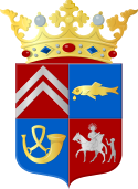
 coat of arms |
| province |
|
| local community |
|
|
Area - land - water |
54.85 km 2 53.96 km 2 0.89 km 2 |
| Residents | 16,122 (Jan. 1, 2017) |
| Coordinates | 52 ° 44 ′ N , 4 ° 45 ′ E |
| Important traffic route |
|
| prefix | 0224, 0226 |
| Postcodes | 1724, 1738, 1746-1747 |
Harenkarspel ( West Frisian Harenkarspel ) ( ) was a municipality in the West Friesland region in the Dutch province of North Holland . Since January 1st, 2013 Harenkarspel belongs to the municipality of Schagen . At the time of the dissolution it had 16,122 inhabitants.
Incorporations; places
The municipality was created on January 1st, 1990 by amalgamating the municipalities of Sint Maarten , Warmenhuizen and the old municipality of Harenkarspel.
Harenkarspel consisted of the following districts. The approximate number of inhabitants in brackets.
- Dirkshorn (1700)
- Tuitjenhorn, including Kalverdijk and Kerkbuurt (3600)
- Waarland (2300)
- Warmenhuizen , including Schoorldam (partially) and Krabbendam (6400)
- Sint Maarten , including 't Rijpje, Eenigenburg, Groenveld, Stroet and Valkkoog (1900 in total)
The municipal administration was based in Tuitjenhorn.
Location; economy
The former municipality is north of Noord-Scharwoude, east of Zijpe and Bergen and south of Schagen . The nearest train stations are in Schagen and Heerhugowaard , which is only about 12 kilometers from Warmenhuizen.
The main sources of income are agriculture and horticulture. But more and more tourists who want to spend the night in a quiet location while enjoying the beach life on the North Sea coast , which is only 10 km away , or visiting the many old cities of North Holland, come to the many small campsites in the former municipality.
Name declarations; history
There was a first dike in this area as early as the 11th century . That was the "West Frisian Omringdijk", the West Frisian surrounding dike . Everyone who owned land behind this dike was a member of a "ban", a community of men who had to maintain the dike. Parts of this old dike are still visible in the polder landscape.
- To 1289 was at Kerkbuurt, near Tuitjenhorn, mound raised. The land belonged to the Abbey of Egmond , whose brothers passed it on to neighboring secular lords and farmers after the reclamation. The original housing estate was later renamed Kerkbuurt, the name of the oldest settlement became the name of the entire municipality.
- The name Waarland is said to come from waardland (Werderland).
- Tuitjenhorn was also mentioned in a document as early as 1289 as t'Uitingehorn . This name is interpreted as headland (horn) at a place where either burials took place or where justice was pronounced. Both etymologies have supporters and opponents.
- In 1289 Warmenhuizen was a group of houses belonging to a certain Wermer. So the name has nothing to do with high temperatures.
politics
Distribution of seats in the municipal council
| Political party | Seats | |||
|---|---|---|---|---|
| 1998 | 2002 | 2006 | 2010 | |
| CDA | 5 | 5 | 6th | 5 |
| PvdA | 3 | 3 | 4th | 4th |
| VVD | 3 | 4th | 3 | 4th |
| General concern | 4th | 5 | 4th | 2 |
| Harenkarspel in moving | - | - | - | 2 |
| Lijst Vlaar-Bergen | 0 | - | - | - |
| total | 15th | 17th | 17th | 17th |
Sons and daughters of the place
- Thomas Dekker (* 1984), racing cyclist
- Marco van Duin (* 1987 in Warmenhuizen), football player
- Gerard Peter Kuiper (1905–1973), astronomer
Web links
Individual evidence
- ↑ a b Bevolkingsontwikkeling; regio per maand Centraal Bureau voor de Statistiek , accessed on May 18, 2018 (Dutch)
- ↑ Allocation of seats in the municipal council: 1998–2002 2006 2010 , accessed on May 18, 2018 (Dutch)
