Smoky Hills
| Smoky Hills | ||
|---|---|---|
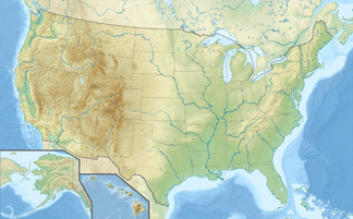
| location | Kansas / Nebraska , United States | |
|
|
||
| Coordinates | 38 ° 48 ′ N , 98 ° 0 ′ W | |
|
The Monument Rocks |
||
The Smoky Hills are rolling hills in the central Great Plains of the United States . They are located in the Midwest and encompass north-central Kansas and a small portion of south-central Nebraska .
The hills are a rugged plain covered by tall grass and mixed grass prairie . The Smoky Hills were formed in the Cretaceous by sedimentary deposits and consist of chalk , limestone and sandstone rocks.
geography
The hills occupy almost all of north central Kansas and are bounded to the west by the High Plains , to the northeast by the Dissected Till Plains , to the east by the Flint Hills and to the south by the lowlands of the Arkansas River . The region extends to south-central Nebraska, where it is bordered to the north by the Rainwater Basin .
They consist of three belts of hills, all of which run southwest to northeast and correspond to the underlying geological formations. The Smoky Hills themselves form the easternmost belt; the two western belts are known as the Blue Hills. The hills of the westernmost belt are also known as Chalk Bluffs. The slope of the Blue Hills forms the border with the High Plains to the west.
The Republican River , Saline River , Solomon River, and Smoky Hill River all flow east through the Smoky Hills from their sources in the High Plains. From the 1940s onwards, the US Army Corps of Engineers and the Bureau of Reclamation dammed these rivers in some places in the Smoky Hills for flood protection and irrigation and created several reservoirs. These include the Cedar Bluff Reservoir , Kanopolis Lake , Kirwin Reservoir , Waconda Lake , Webster Reservoir, and Wilson Lake .
Elevations in the Smoky Hills range from about 370 m (1200 feet ) in the river valley at Salina to 730 m (2400 feet) on the western edge of the region. The land is mainly used as arable land and grazing land. The region is sparsely populated with numerous communities of different sizes, but without large cities. The two largest communities in the region are Salina and Hays . Chalk, sandstone and limestone predominate, which has developed striking shapes in some places due to erosion, for example in Mushroom Rock State Park .
Web links
Individual evidence
- ^ Geologic Regions . In: GeoKansas . Kansas Geological Survey. April 12, 2005. Retrieved February 19, 2010.
- ^ A b Ecoregions of Nebraska and Kansas . Environmental Protection Agency . Retrieved on February 19, 2010 ( page no longer available )
- ^ Fishes of the Kansas River System in Relation to Zoogeography of the Great Plains. Retrieved July 22, 2019 .
- ↑ George I. Adams: Physiographic Divisions of Kansas . Ed .: American Geographical Society. S. 89-104 .
- ^ History of Kanopolis Dam . US Army Corps of Engineers . Archived from the original on January 9, 2009.
- ^ Pick Sloan Missouri Basin Program Project . US Bureau of Reclamation.
- ^ Topo USA, DeLorme, 6.0


