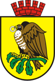
Sokołów Podlaski
| Sokołów Podlaski | ||
|---|---|---|

|
|
|
| Basic data | ||
| State : | Poland | |
| Voivodeship : | Mazovia | |
| Powiat : | Sokołów Podlaski | |
| Area : | 17.51 km² | |
| Geographic location : | 52 ° 24 ' N , 22 ° 15' E | |
| Residents : | 18,946 (Jun. 30, 2019) |
|
| Postal code : | 08-300 | |
| Telephone code : | (+48) 25 | |
| License plate : | VAC | |
| Economy and Transport | ||
| Street : | DK63 | |
| Next international airport : | Warsaw | |
| Gmina | ||
| Gminatype: | Borough | |
| Residents: | 18,946 (Jun. 30, 2019) |
|
| Community number ( GUS ): | 1429011 | |
| administration | ||
| Mayor : | Bogusław Karakula | |
| Address: | ul.Wolności 21 08-300 Sokołów Podlaski |
|
| Website : | www.sokolowpodl.pl | |
Sokołów Podlaski is a town and seat of the rural municipality of the same name in the powiat Sokołowski of the Masovian Voivodeship , Poland .
local community
Borough
The city of Sokołów Podlaski forms an independent municipality.
Rural community
The rural community of Sokołów Podlaski, to which the town does not belong, has an area of 137.61 km².
Buildings
- Roman Catholic co-cathedral "Sacred Heart of Mary" .
Town twinning
- Jēkabpils , Latvia since 1987.
Personalities
sons and daughters of the town
- Anna Jesień (* 1978), Polish athlete
- Krystyna Dąbrowska (* 1973), Polish chess player
- Patrycia Ziółkowska (* 1979), German actress
- Zofia Kielan-Jaworowska (1925–2015), Polish vertebrate paleontologist, specialist in early mammals
Web links
Commons : Sokołów Podlaski - collection of pictures, videos and audio files
Individual evidence
- ↑ a b population. Size and Structure by Territorial Division. As of June 30, 2019. Główny Urząd Statystyczny (GUS) (PDF files; 0.99 MiB), accessed December 24, 2019 .

