
Sousbach
| Sousbach | ||
|
|
||
| Data | ||
| Water code | CH : 1832 | |
| location |
Bernese Alps
|
|
| River system | Rhine | |
| Drain over | Weisse Lütschine → Lütschine → Aare → Rhine → North Sea | |
| Source height | approx. 2450 m above sea level M. | |
| muzzle | north of Lauterbrunnen -Sandweidli Coordinates: 46 ° 36 ′ 56 ″ N , 7 ° 54 ′ 9 ″ E ; CH1903: 635 526 / 162 792 46 ° 36 '56 " N , 7 ° 54' 9" O |
|
| Mouth height | 708 m above sea level M. | |
| Height difference | approx. 1742 m | |
| Bottom slope | approx. 20% | |
| length | approx. 8.9 km | |
| Catchment area | 20.88 km² | |
| Discharge A Eo : 20.88 km² at the mouth |
MQ Mq |
1.13 m³ / s 54.1 l / (s km²) |
The Sousbach is a creek about 9 kilometers long that flows from the Soustal into the Lauterbrunnen valley in the Bernese Oberland , where it flows from the left into the Weisse Lütschine .
geography
course
The Sousbach arises at about 2450 m above sea level. M. at Hüenderegg at the foot of the Schilthorn .
From there it flows in a northeasterly direction through Türliboden , with several small tributaries flowing towards it. Shortly after Oberberg ( 1990 m above sea level ) it goes steeply down, whereupon at an altitude of 1800 m above sea level. M. the Strycher flows to him from the left. The two streams run only about 300 m apart, almost parallel over a distance of about 2 km, although they are also separated by a ridge about 100 m high. At an altitude of about 1700 m above sea level. M. the Chantbach rushes to him from the left. Shortly afterwards, the Sousbach continues into wooded area. At an altitude of about 1200 m above sea level. M. he takes his last larger tributary, the Sulsbach from the left. From here the stream changes its direction more towards the east and comes into the Lauterbrunnen valley .
The last section of the stream remains steep; to Sandweidli, it overcomes a height difference of almost 500 m over a distance of about 1.3 km. There it finally flows out at an altitude of 708 m above sea level. M. from the left into the Weisse Lütschine coming from the south .
Its 8.9 km long run ends around 1742 meters below its source, so it has an average bottom gradient of around 20%.
Catchment area
The catchment area of the Sousbach has a size of just over 20 km². The Schilthorn is the highest point in the catchment area and reaches a height of 2970 m above sea level. M. The mean height of the catchment area is 2117 m above sea level. M. , the minimum height is 707 m above sea level. M.
The entire catchment area of the stream is only very sparsely populated.
It consists of 12.6% wooded area , 41.2% agricultural area , 0.4% settlement area , 0.5% glacier / firn, 0.8% water area and 44.5% from unproductive areas.

Tributaries
Inflows from the source to the mouth with name, orographic direction , length in kilometers, catchment area in km², mouth location, mouth height. The names of the streams come from the WebGIS of the canton of Bern, some of the data from swisstopo .
- Hiendereggbach ( left ), 0.7 km
- Schlächtimattengraben I ( right ), 0.3 km
- Schlächtimattengraben III ( right ), 0.5 km
- Schlächtimattengraben IV ( right ), 0.2 km
- Tirlibodenbächli I ( left ), 0.2 miles
- Schlächtimattengraben V ( right ), 0.4 km
- Altslägergraben II ( right ), 0.2 km
- Morgeweidgraben I ( right ), 0.2 km
- Morgeweidgraben II ( right ), 0.2 km
- Strycher ( left ), 3.6 km, 3.04 km²
- Spitalbächli ( right ), 0.4 km
- Färrichwaldbächli ( left ), 0.3 km
- Scheenbielgräbli ( right ), 0.3 km
- Chantbach ( left ), 2.8 km, 1.84 km²
- Inners Steckgräbli ( left ), 0.2 km
- Ussers Steckgräbli ( left ), 0.2 miles
- Steinleuibach ( right ), 0.3 km (with Usser Steinleuibach 0.5 km)
- Bletschenbächli ( left ), 0.2 km
- Standbächli ( right ) 0.4 km
- Inners Luserenbächli ( right ), 0.4 km
- Luserenbächli ( right ), 0.3 km
- Stapfbächli ( left ), 0.2 km
- Milibächli ( right ), 0.2 km
- Alpiglenschopfbächli ( right ), 0.3 km
- Ischflüöbächli ( right ), 0.1 km
- Schueriberggräbli ( left ), 0.2 km
- Gribligfluebächli ( right ), 0.3 km
- Leidrichgraben ( right ), 0.5 km
- Becklifurengräbli ( right ), 0.5 km
- Brichbächli ( left ), 0.4 miles
- Geissgraben ( right ), 0.3 km
- Treichrichgraben ( left ), 0.5 km
- Sulsbach ( left ), 3.9 km, 3.64 km²
- Hacketegräbli ( right ), 0.2 km
- Senggigräbli ( left ), 0.2 km
- Ds Wässerli ( left ), 0.3 km
Hydrology
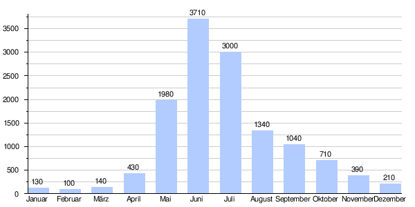
At the confluence of the Sousbach into the Weisse Lütschine, its modeled mean flow rate (MQ) is 1,130 l / s. Its discharge regime type is nival alpine and its discharge variability is 18.
Individual evidence
- ↑ a b c Geoserver of the Swiss Federal Administration ( information )
- ↑ a b c d Topographical catchment areas of Swiss waters: sub-catchment areas 2 km². Accessed January 21, 2020 .
- ↑ "Hidden behind the mean values" - the variability of the discharge regime , p. 119
- ↑ The discharge variability describes the extent of the fluctuations in the mean discharge of individual years around the long-term mean discharge value.