Springfield Township (Montgomery County, Pennsylvania)
| Springfield Township | ||
|---|---|---|
 Black Horse Inn (2012) |
||
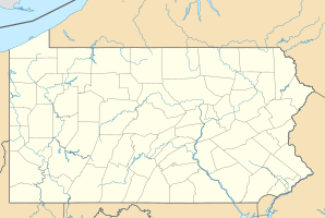
| Location in Pennsylvania | ||
|
|
||
| Basic data | ||
| Foundation : | 1681 | |
| State : | United States | |
| State : | Pennsylvania | |
| County : | Montgomery County | |
| Coordinates : | 40 ° 6 ′ N , 75 ° 12 ′ W | |
| Time zone : | Eastern ( UTC − 5 / −4 ) | |
| Residents : | 19,533 (as of: 2000) | |
| Population density : | 1,109.8 inhabitants per km 2 | |
| Area : | 17.6 km 2 (approx. 7 mi 2 ) of which 17.6 km 2 (approx. 7 mi 2 ) is land |
|
| Height : | 84.1 m | |
| Area code : | +1 215 | |
| FIPS : | 42-73088 | |
| GNIS ID : | 1216872 | |
| Website : | www.springfield-montco.org | |
The Springfield Township is located in Montgomery County in the state of Pennsylvania in the United States of America . The township includes the communities of Erdenheim, Oreland, Flourtown and Wyndmoor . A total of 19,533 inhabitants live in the township according to the 2000 census. According to official information, the total area of the municipality is 17.6 km², of which 0.15% is water and the rest is land.
history
Springfield Township was a gift from William Penn to his first wife, Gulielma Maria Springett Penn. "Gulielma Maria Penns Mannor of Springfield" was first mentioned on a map in 1681 and this date is also mentioned in the township seal. A first written reference to the township of "Springfield" can be found in 1718.
During the 18th century agriculture was the main source of income in the community, immediately followed by lime distilleries and the operation of flour mills. The Wissahickon Creek and three of its tributaries enabled the operation of at least three water-powered mills. The name of the later district Flourtown (in German "Mehlstadt") can be traced back to these mills .
Attractions
- Black Horse Inn , historic establishment
