
St. Anna Hut
| St. Anna Hut PWV Hut |
||
|---|---|---|
 St. Anna Hut |
||
| location | Haardt (Palatinate Forest) ; at Burrweiler ; District of Südliche Weinstrasse , Rhineland-Palatinate | |
| Mountain range | Palatinate Forest | |
| Geographical location: | 49 ° 15 '4 " N , 8 ° 3' 50" E | |
| Altitude | 438 m | |
|
||
| owner | Palatinate Forest Association | |
| Construction type | Hut; Sandstone, wood | |
| Usual opening times | Wednesday, Sunday, Holidays | |
| Web link | St. Anna Hut | |

The St. Anna Hut , or Burrweiler Hut , is a refuge in the Palatinate Forest managed by the Burrweiler section of the Palatinate Forest Association . It stands in the Haardt on the eastern slope of the Teufelsberg ( 597.6 m above sea level ) above Burrweiler in the Rhineland-Palatinate district of Südliche Weinstrasse .
Geographical location
The St. Anna Hut is located in the southern part of the Haardt Palatinate Forest in the Palatinate Forest-Vosges du Nord Biosphere Reserve and Palatinate Forest Nature Park . It stands at about 438 m above sea level on the eastern slope of the Teufelsberg called Annaberg, about 110 m northwest of the St. Anna Chapel, known as the pilgrimage chapel and pilgrimage church . The mountainside falls east to south-east to Burrweiler in the Upper Rhine Plain .
history
When the local group Burrweiler of the Palatinate Forest Association was founded in 1969, the hut was taken over. The inauguration took place in 1971 after extensive construction work (electricity and water supply, kitchen, toilets).
Access and walks
The St. Anna hut can be reached on foot. Various ascent routes are possible from Burrweiler and Gleisweiler . The Way of the Cross to the St. Anna Chapel can be chosen as the most interesting ascent . Another access can be made from Buschmühle in Modenbachtal in about 30 minutes.
As a hiking destination near the hut, the Teufelsberg with the Teufelsfelsen and the Wetterkreuz can be reached. The neighboring huts of the Palatinate Forest Association are the Trifelsblick Hut , the Landauer Hut and the Schweizerhaus .
From Annaberg there is a view of the Rhine plain .
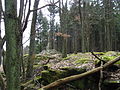
Picture gallery

St. Anna Hut

St. Anne's Chapel

St. Anne's Chapel
Teufelsberg summit with weather cross


Individual evidence
- ↑ St. Anna Hut in a topographical map in the map service of the landscape information system of the Rhineland-Palatinate Nature Conservation Administration, accessed on January 26, 2017
- ↑ history of the club , information u. a. to the St. Anna hut at the Palatinate Forest Association e. V. - Local group Burrweiler , on pwv-burrweiler.de
literature
- Anne Kathrin Doerr: Palatinate Hüttenbuch - The guide to 99 rest houses and hikers' homes . Pfälzische Verlagsanstalt Ludwigshafen GmbH, 4th edition June 2018, ISBN 978-3-87629-341-7 , p. 19.
- Matthias Wittber: Palatinate Forest with Bienwald. Bruckmann Verlag, 2009, ISBN 978-3-7654-4287-2 .
- Pietruska hiking map: Edenkoben - the holiday region between Landau and Neustadt. 1: 25000, 3rd edition, Pietruska Verlag, Rülzheim 2018, ISBN 978-3-945138-04-5 .
- Pietruska hiking map: Hauenstein & Trifelsland. 1: 25000, 3rd edition, Pietruska Verlag, Rülzheim 2017, ISBN 978-3-945138-02-1 .
- ML Lamm: The St. Annakapelle zu Burrweiler , Pilger-Verlag, Speyer, ISBN 3-87637-078-7 .
Web links
- St. Anna Hut in a topographic map in the map service of the landscape information system of the Rhineland-Palatinate nature conservation administration
- Palatinate Forest Association (official homepage)