
Stanley, County Durham
| Stanley | |||
|---|---|---|---|
 |
|||
| Coordinates | 54 ° 52 ′ N , 1 ° 42 ′ W | ||
| OS National Grid | NZ197525 | ||
|
|||
| Residents | 21,938 (as of ( 2011 Census )) | ||
| surface | 5.38 km² (2.08 mi² ) | ||
| Population density: | 4078 inhabitants per km² | ||
| administration | |||
| Post town | Stanley | ||
| prefix | 01207 | ||
| Part of the country | England | ||
| region | North East | ||
| Shire county | County Durham | ||
| District | Durham | ||
| British Parliament | North Durham | ||
| Website: http://www.stanley-tc.gov.uk | |||

Stanley is a town and an administrative unit in the District County Durham in County Durham , England.
location
Stanley is in the hill country south of the River Tyne . It is approximately 15 km southwest of Newcastle-upon-Tyne , approximately 10 km west of Chester-le-Street , approximately 15 km west of Durham and approximately 10 km east of Consett .
history
Archaeological finds in the area date back to the Stone Age . For Stanley himself, however, they are very sparse; Iron Age tools and Roman coins have been found here and there.
The place is first mentioned in a document in 1211 as Stanlegh . The name is derived from the Old English name for a stony open space. There was a mansion from 1394 between Stanley and Tanfield . It was demolished in the 1930s.
Due to the coal mining industry, Stanley grew rapidly and became a mining and industrial town. At the peak of coal mining there were 46 coal mines within a 3 km radius of the town center. Nowadays there is no longer any coal mining in the area, but traces of it can still be found, e.g. B. spoil heaps, rockslides or backfilled pits.
Buildings
There are several quite old church buildings in the city itself. The community and administration center is located in a renovated former factory building on the western edge of the town center. The Louisa Center, a modern sports and leisure center, is in the immediate vicinity . The North of England Open Air Museum is located between Stanley and Newcastle .
Economy and population
After the decline of mining and heavy industry in the 1980s, the town's economic situation has remained difficult. Stanley now benefits from its location in the Newcastle catchment area. The majority of all employees work in the service sector or in manufacturing, the unemployment rate is around 6% higher than the national average.
The average age of the population is 40 years, there are hardly any ethnic minorities in the village.
Infrastructure
Stanley no longer has a rail link. It is on the A693 connected to the neighboring towns of Consett and Chester-le-Street, on the A6076 you reach Newcastle. The bus station is a hub for the bus routes in the area.
sons and daughters of the town
- Brian Tinnion (* 1968), football player and coach
photos

Citizens and administrative center

The Louisa Center, sports and leisure center

A693 in the district of Oxhill

Residential area in the southern part of the city
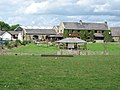
Hotel South Causey Inn on the northern edge of the city


Individual evidence
- ↑ a b c Local Area Report for the City of Stanley on the nomisweb information system of the Office for National Statistics ; accessed on March 3, 2020.
- ^ Ordnance Survey: Stanley ( English ) Ordnance Survey Linked Data. Retrieved March 3, 2020.
- Jump up ↑ Stanley Mining History on the parish home page. Retrieved March 3, 2020.
- ↑ Representation of the Louisa Center on the homepage of County Durham. Retrieved March 3, 2020.
Web links
- Stanley's story on keystofthepast.info , the Northumberland and Durham Counties History page.