Staupenbach
| Staupenbach | ||
|
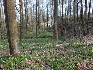
The Staupenbach northeast of Wendishain . In the background of the picture is its confluence with the Freiberg Mulde . |
||
| Data | ||
| location | Hartha , District of Central Saxony , Saxony , Germany | |
| River system | Elbe | |
| Drain over | Freiberger Mulde → Mulde → Elbe → North Sea | |
| source | On the southwestern outskirts of Nauhain , district of Hartha 51 ° 7 ′ 6 ″ N , 12 ° 59 ′ 32 ″ E |
|
| muzzle | Northwest of Westewitz in the Freiberger Mulde Coordinates: 51 ° 8 '30 " N , 13 ° 0' 35" E 51 ° 8 '30 " N , 13 ° 0' 35" E
|
|
The Staupenbach is a flowing water in the Saxon town of Hartha in the district of Central Saxony .
The stream has its source on the southwestern outskirts of Nauhain , a district of Hartha. From there it flows largely in a northeasterly direction through Nauhain and through the Staupenbachtal nature reserve . It flows northwest of Westewitz into the Freiberger Mulde .
