Bitburg reservoir
| Bitburg reservoir | |||||||
|---|---|---|---|---|---|---|---|
|
|||||||
|
|
|||||||
| Coordinates | 50 ° 0 '59 " N , 6 ° 26' 26" E | ||||||
| Data on the structure | |||||||
| Construction time: | 1970-1972 | ||||||
| Height above foundation level : | 18 m | ||||||
| Height of the structure crown: | 260 m above sea level NHN | ||||||
| Crown length: | 90 m | ||||||
| Crown width: | 10 m | ||||||
| Slope slope on the air side : | 1: 2.2 | ||||||
| Slope slope on the water side : | 1: 1.75 | ||||||
| Data on the reservoir | |||||||
| Altitude (at congestion destination ) | 256 m above sea level NHN | ||||||
| Water surface | 39.3 ha | ||||||
| Storage space | 1 200 000 m³ | ||||||
| Total storage space : | 2 400 000 m³ | ||||||
| Catchment area | 330 km² | ||||||
| Design flood : | 240 m³ / s | ||||||
| Particularities: |
First dam structure with foil seal in Germany |
||||||
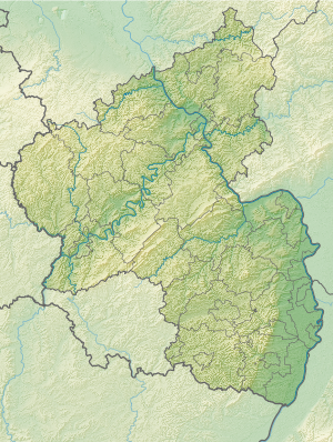
The Bitburg reservoir is a flood retention basin and is located on the Prüm in Biersdorf am See and Wiersdorf in the Eifel , about twelve kilometers northwest of Bitburg in Rhineland-Palatinate .
The dam , a 15-meter-high earth dam, was built by the Bitburg Reservoir Association for flood protection at a point where the narrow and deeply cut valley of the Prüm opens into a hollow, which used to be always at risk of flooding . The reservoir , which is around two kilometers long and up to nine meters deep, is used for low water regulation , energy generation and local recreation and has become a popular excursion destination and tourist center in the southern Eifel. There is a five-kilometer circular path around the lake and many other good hiking trails, some of which are illuminated at night. This is where the network of hiking trails in the German-Luxembourg Nature Park begins .
Sports and leisure opportunities include rowing, paddling, surfing, pedal boating, inline skating, mountain biking, badminton, cycling and fishing (trout). There is a large fountain in the middle of the lake.
See also
Web links
- Entry for the Bitburg reservoir in the database of cultural assets in the Trier region .
- Bitburg reservoir at "www.eifel-gps.de"
- Bitburg reservoir in Biersdorf am See at "www.eifel-direkt.de"
- Bitburg reservoir in Biersdorf am See at "www.eifel.de"
- Recordings from the lake (private website)


