Steinbach (Fischbach)
| Steinbach | ||
| Data | ||
| Water code | DE : 264368 | |
| location | Germany | |
| River system | Rhine | |
| Drain over | Fischbach (Saar) → Saar → Moselle → Rhine → North Sea | |
| source | in Malstatt 49 ° 17 ′ 51 ″ N , 6 ° 57 ′ 41 ″ E |
|
| muzzle | in Malstatt in den Fischbach (Saar) Coordinates: 49 ° 16 '2 " N , 6 ° 59' 10" E 49 ° 16 '2 " N , 6 ° 59' 10" E
|
|
| length | approx. 5.2 km | |
| Catchment area | 6.02 km² | |
| Left tributaries | Oberer Jungfleischbach, Unterer Jungfleischbach, Wildsaugraben, wash well | |
| Right tributaries | Upper Salzleckerrothbach, Lower Salzleckerrothbach, Sommersgraben, Holländerbrunnen, Steinbachgraben, Emsenbruch, Mittelste Steinebach, Unterste Steinebach | |
| Flowing lakes | Gouvysweiher, Steinbachweiher, Steinbachweiher | |
| Big cities | Saarbrücken | |
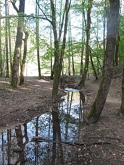
The Steinbach is a right tributary of the Fischbach . It flows through the nature reserve Waldschutzgebiet Steinbachtal-Netzbachtal in Saarbrücken , which is part of the Saar coal forest .
geography
course
The source of the Steinbach is located near the intersection of the two state roads L128 and L259 in a part of the Saarkohlenwald within Malstatt . The stream crosses the L259 state road underground. From there it flows as the main body of water in the Steinbachtal mainly in a south-westerly direction. After crossing the Gouvysweiher, it initially flows mainly in a southerly direction and crosses two ponds, which are called Steinbachweiher. The Urwaldtour hiking trail also leads along here. It then flows westwards until it flows into the Fischbach .
Renaturation
The Steinbach and its tributaries have been greatly changed by people. For example, the waters were passed through small-diameter pipes under paths. Among other things, this prevented animals such as fish and insects from migrating up these waters. When the then Saarland Environment Minister Willy Leonhardt and the then state chairman of the NABU Stefan Mörsdorf made the decision on April 25, 1997 to declare the Steinbachtal a forest protection area, measures to renaturate the waters there were also decided. The renaturation measures began on September 23, 2003 and were completed in 2004. In the course of these measures, paths were dismantled and thus the waters were also exposed. Where this was not possible, the fords were integrated into the paths or at least the narrow pipes were replaced by pipes with a wider diameter.
Web links
Individual evidence
- ↑ a b c GeoPortal Saarland
- ↑ Ralf Kohl: Wild Waters. Wild waters in the "primeval forest at the gates of the city" - renaturation measures in the "Stein- und Netzbachtal forest protection area". NABU Saarbruecken, accessed on November 13, 2019 .
