Hard coal mining in the Deister
The coal-mining industry in the Deister was over several centuries an important economic activity around the Deister . The coal mined was from the Lower Cretaceous Period (approx. 100 to 140 million years old) and found in seams with a maximum thickness of 100 cm. Mining was stopped in 1956 (Barsinghausen colliery) and 1960 ( Strutzbergstollen ) due to a lack of profitability .
history

After probably much earlier superficial excavations, the first written evidence is a mining permit from 1588. The first verifiable mine was in the Bröhn area in 1639 . Its mining rights were acquired in 1807 by the entrepreneur Johann Egestorff , der Kohlen u. a. needed for his lime distilleries.
In the area of the eastern Deister it was the barons of Knigge who operated mining at Steinkrug and Bredenbeck .
With the opening of the Deisterbahn in 1872, the transport options were improved. Some tunnels were connected to the main line with sidings or field railways . Larger mines emerged in Barsinghausen (initially under the leadership of the monastery chamber) and in Bantorf . Pit horses were often used within the tunnels . From 1899 freight trains of the Hanover tram were also used to transport the coal.
Due to the increasing exhaustion of the storages accessible via tunnels, towards the end of the 19th century more and more people switched to underground construction using shafts . At the turn of the century, the technology could also be improved using pit ventilators and compressed air for devices such as the pick hammer and later also shaking chutes .
Due to the low thickness of the seams and the strong water inflow, the Deist coal could no longer hold its own against other competitors after a last high in the post-war years. The Barsinghausen colliery was closed in 1956/1957, only a few small tunnels continued to mine for a few years.
Since the 1990s, the Barsinghausen monastery tunnel and the Feggendorfer tunnel have been working on the restoration of facilities for demonstration and museum operations. Both systems are now accessible to visitors.
List of mining facilities in the Deister
The information in column "No." refer to the 39 numbers in the overview map from Horst Krenzel: Memories of hard coal mining in the Deister Mountains, page 12; they run roughly from northwest to southeast.
| No. | Surname | visible today | Geographic coordinates | image | Remarks |
|---|---|---|---|---|---|
| 1 | Feggendorf tunnel | Oral hole , studs , devices | Orifice 52 ° 17 '29.2 " N , 9 ° 24' 34.4" O , Jägerwegrösche
|
 more pictures |
Redevelopment AG Feggendorfer Stolln |
| 2 | Hohenbosteler tunnel | Mouth hole with steel door | Orifice 52 ° 18 '27.5 " N , 9 ° 25' 15.1" O | 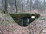 |
in operation from 1831–1895, today water extraction |
| 3 | Antonie colliery | Colliery house | Shaft 52 ° 19 ′ 35 ″ N , 9 ° 25 ′ 9.3 ″ E | 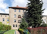 |
Bantorf , in operation from 1859 to 1928. Colliery house converted into apartments |
| 4th | Mooshütte tunnel | Concrete mouth hole | Orifice 52 ° 19 '22.1 " N , 9 ° 24' 2.1" O |
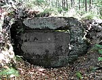 more pictures |
Bad Nenndorf , in operation 1951–1954 |
| 5 | Strutzberg tunnel | Mouth hole (bricked up), dump | Orifice 52 ° 19 '5.8 " N , 9 ° 23' 54.9" O |
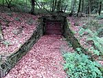 more pictures |
Bad Nenndorf, in operation 1952–1960 |
| 6th | Bullerbach shaft | Terrain plateau, retaining wall | 52 ° 17 '53.5 " N , 9 ° 25' 54.5" E |  |
In operation from 1890–1930, mainly the weather shaft (pit ventilator) of the monastery tunnel |
| 7th | Ministerial adit | Halde, Bremsberg, Steigergrotte | 52 ° 17 ′ 41.6 " N , 9 ° 25 ′ 50.9" E |
 more pictures |
"Community mine", in operation from 1831–1896? |
| 8th | Lower Sammann tunnel | Mouth hole (closed) | 52 ° 17 ′ 26.6 " N , 9 ° 26 ′ 49.8" E | 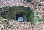 |
opened in 1831, today water extraction |
| 9 | Upper Sammann tunnel | Dump, debris from the mouth hole | Information board: 52 ° 17 ′ 6.9 ″ N , 9 ° 26 ′ 21.5 ″ E |  |
today water extraction |
| 10 | Barsinghausen monastery tunnel | Visitor mine | Orifice 52 ° 17 ′ 57 ″ N , 9 ° 28 ′ 11.7 ″ E , weather well 52 ° 17 ′ 25.9 ″ N , 9 ° 27 ′ 28.1 ″ E |
 more pictures |
Alte Zeche GmbH visitor mine |
| 11 | Barsingh. Civil engineering shafts I, II, III | Shaft I 52 ° 17 ′ 56.8 ″ N , 9 ° 28 ′ 13.7 ″ O Shaft II 52 ° 17 ′ 57.3 ″ N , 9 ° 28 ′ 12.5 ″ O Shaft 3 52 ° 17 ′ 55, 1 ″ N , 9 ° 28 ′ 10.2 ″ E |
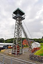 |
on the visitor mine site | |
| 12 | Barsingh. Underground construction shaft IV | Dump stump | 52 ° 19 '6.9 " N , 9 ° 29" 47.7 " E |  |
Most of the heap cleared, marketed as "Haldenrot", today excavated earth landfill |
| 13 | Old-baptism-studs | Retaining walls, foundations | Orifice 52 ° 16 '19.9 " N , 9 ° 26' 1.5" O |  |
The tunnel collapsed just behind the mouth hole |
| 14th | Teufelskammer tunnel | Mouth hole (sunken), heap | Orifice 52 ° 16 '22.9 " N , 9 ° 26' 39.2" O |  |
|
| 15th | Vicious chamber rose | Stones | 52 ° 16 ′ 20.6 " N , 9 ° 26 ′ 50.6" E |  |
|
| 16 | Lower Sürsserbrinker tunnel | Depression (former mouth hole), dump | Depression 52 ° 15 ′ 43.4 ″ N , 9 ° 29 ′ 52.1 ″ E | ||
| 17th | Upper Sürsserbrinker tunnel | Mouth hole, dump | 52 ° 15 '31.1 " N , 9 ° 29" 34.8 " E |
 more pictures |
Colliery used as Schleifbachhütte until 2016, burned down. Demolished in 2017, mouth fenced. |
| 18th | Alter-König-Wilhelm-Stollen | Heap | former mouth hole 52 ° 16 ′ 4.4 ″ N , 9 ° 30 ′ 35.9 ″ O |
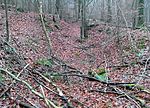 more pictures |
Designation according to Krenzel. (Also Neuer Stolln, Königlicher Sürsserbrinker Stollen, most recently: (Old) König-Wilhelm-Stollen) |
| New-König-Wilhelm-Stollen | Mouth hole, dump | Orifice 52 ° 16 '15.3 " N , 9 ° 30' 42.8" O |
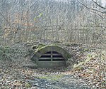 more pictures |
Initially "Der Hauptstollen", known as the railway (er) tunnel. In operation from 1860–1901. | |
| 19th | Egestorf tunnel | Mouth hole (barred), dump | Orifice 52 ° 16 '23 " N , 9 ° 29' 51.4" O |
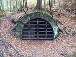 more pictures |
in operation from 1874–1898. The colliery at the Egestorfer entrance built in 1875/76 later became the Kniggenbrink forester's house. |
| 20th | Egestorf entrance | only information board | Entrance 52 ° 16 ′ 37.1 ″ N , 9 ° 30 ′ 11.6 ″ E |  |
Completed in 1907, stairwell to the monastery tunnel pit |
| 21st | High waiting tunnel | Oral hole (new, bricked up) Bremsberg |
Orifice 52 ° 16 '4.4 " N , 9 ° 28' 59.1" E Bremsberg 52 ° 16 '33.4 " N , 9 ° 29' 58.6" E |
 |
in operation 1845–1877, 1923–1928, 1936–1937. |
| 22nd | Hohe-Warte entrance | Burglary hollow, remains of a wall | 52 ° 15 '58.9 " N , 9 ° 28' 27.4" E |  |
in operation 1922–1935. |
| Hohe-Warte-Rösche | Depression (former mouth hole), dump | Depression 52 ° 15 ′ 57.4 ″ N , 9 ° 27 ′ 53.1 ″ E |  |
in operation 1919 / 20–1942? | |
| 23 | Green Brink Stollen | Remnants of foundations, heap, mining forge | Heap 52 ° 15 '56.1 " N , 9 ° 27' 46.3" E |
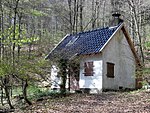 more pictures |
in operation from 1935 to 1942. |
| 24 | Hoffmann tunnel II | Mouth hole (bricked up) | Orifice 52 ° 15 '56.2 " N , 9 ° 28' 38.4" O | 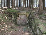 |
in operation 1956–1958. |
| 25th | Hoffmann tunnel I | Depression (former mouth hole), dump | Orifice 52 ° 15 '58.2 " N , 9 ° 28' 30.1" O |  |
in operation 1955–1957. Use of the stockpile and loading point of the Hohe-Warte entrance, colliery building at Hoffmannstollen II. |
| 26th | Pits on the Bröhn | Hollows, heaps | 52 ° 15 '32.3 " N , 9 ° 31' 30.4" E |  |
see: Information board at Georgsplatz |
| 27 | Georgstollen | Wall remains | 52 ° 15 '11.9 " N , 9 ° 33' 3.6" E |  |
From 1854. Ground leveled around 1980, afforested. Also called the Wöltje tunnel. |
| - | Deep Georgstollen | Light shaft heaps | (M) , Halden 1 2 3 | 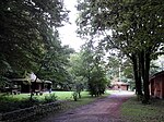 |
Water solution gallery, built from 1852 to 1866. Former mouth in a shaft on the site of the Finnhütten. Broken under light shaft 1. |
| - | Dorotheenschacht | 4 m deep crater; Heap | Incidence 52 ° 15 '32.9 " N , 9 ° 31' 40.8" E |
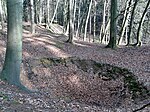 more pictures |
In operation from 1878–1924, crater fenced since 2017 |
| 28 | Upper Feldberg tunnel | Mouth hole | 52 ° 15 '9.4 " N , 9 ° 31' 13.1" E | 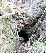 |
in operation from 1854. |
| 29 | Hülsebrink studs | Mouth hole, dump | 52 ° 14 '51.8 " N , 9 ° 31' 39.5" E |
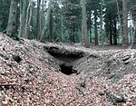 more pictures |
in operation 1847, 1921–1924. |
| 30th | Lower Deisterstollen (Mögebierstollen) | Mouth hole (new) | 52 ° 15 '0.4 " N , 9 ° 32' 34.8" E |
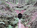 more pictures |
Refurbishment: website |
| 31 | Upper Deisterstollen | Mouth hole | 52 ° 14 '55.6 " N , 9 ° 32' 26.2" E |
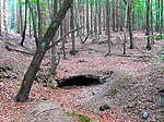 more pictures |
in operation 1775–1866 |
| 32 | Good Hope Stollen | Slope cut, dump | 52 ° 14 '50.2 " N , 9 ° 35' 4.1" E |  |
in operation from 1890 to 1907 (or 1922). Horse-drawn tram towards Bredenbeck lime works . Orifice destroyed in the 1980s |
| 33 | Frauenwegschacht | Sink, dump | 52 ° 14 '37.5 " N , 9 ° 35' 44.4" E |  |
|
| 33 | August shaft | Sink, dump | Depression 52 ° 14 ′ 28.6 ″ N , 9 ° 35 ′ 42.7 ″ E |  |
|
| 34 | Ernst Stollen | Weather shafts | Weather shafts 3 5 6 7 8 |  |
Water solution tunnel of the Karlschacht, in operation from 1885–1909 |
| 35 | Hertha colliery (Karl-Schacht) | Collapse crater, dump | 52 ° 14 '50.1 " N , 9 ° 36' 14.3" E |  |
At the Bredenbeck lime works. Hertha colliery since 1904. Backfilled after shutdown in 1909, crashed approx. 30 m deep in 1988, fenced |
| 36 | Leo shaft | Depression and dump | Leo Manhole 52 ° 14 ′ 30.7 " N , 9 ° 36 ′ 23.4" E |  |
|
| 36 | Gesenk and Östl. Sole shaft | Depression, heaps | East Sole shaft 52 ° 14 ′ 19.9 ″ N , 9 ° 36 ′ 25.2 ″ E |  |
|
| 37 | Moritz shaft, fundus shaft, care shaft | sink and heap respectively | Moritz shaft: 52 ° 13 ′ 52.8 ″ N , 9 ° 36 ′ 30.3 ″ O Fundus shaft: 52 ° 13 ′ 45.5 ″ N , 9 ° 36 ′ 51 ″ O Sor shaft: 52 ° 13 ′ 44.3 ″ N , 9 ° 36 '42.1 " E |
 |
Shafts at Rehborn, sunk from 1804; closed in 1884 (fundus shaft) |
| 38 | Auguste-Martha shaft | Heap | 52 ° 13 '43 " N , 9 ° 37' 5.8" E |  |
aka Anna-Margarethe Shaft. In operation from 1871–1907, emergency mining 1945–1949. |
| 39 | Wilhelm tunnel | Heaps, sinks (weather shafts) | Weather shafts 2 4 5 6 |  |
in operation from 1810–1890. Stollenmund on the Bredenbeck brook. Shaft 5 served as a delivery shaft. |
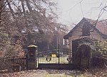
| - | Old tunnels on Daberg | Light shafts, sink, colliery house | Light shaft 52 ° 13 ′ 28.9 ″ N , 9 ° 37 ′ 43.8 ″ O Light shaft 52 ° 13 ′ 35.6 ″ N , 9 ° 37 ′ 38.9 ″ O Lower shaft 52 ° 13 ′ 37.6 ″ N , 9 ° 37 '12.3 " E |
 |
literature
- Horst Krenzel: Memories of the hard coal mining in the Deister Mountains . 3rd edition 1999, Horb am Neckar, ISBN 3-89570-195-5 , in the GVK catalog
- Matthias Brodtmann, Eckard Steigerwald: Barsinghausen. Under clapper, mallet and iron . 2nd edition, Barsinghausen 2010, without ISBN, in the GVK catalog
- Horst Falke: The Wealden coal mining in Lower Saxony . Stalling, Oldenburg 1944; in the GVK catalog
- Friends of the visitor mine Barsinghausen eV (ed.): The Deister coal paths . Barsinghausen 2014, without ISBN
- Natural History Society Hannover (ed.): The Deister. Natur.Mensch.Geschichte , Naturhistorica series - Reports of the Natural History Society Hanover, Volume 131 (1989/2017), to Klampen Verlag, Springe 2017, 672 pages, ISBN 978-3-86674545-2
Web links
- Article on the history of Deister mining at Schatzsucher.de
- Video film on hard coal mining on the Deister in the history atlas school project (4:30 minutes)
Individual evidence
- ^ Matthias Brodtmann: Barsinghausen. Under clapper, mallet and iron (see below), page 82f
- ↑ Map section at www.barsinghausen.de
- ↑ deisterbergbau.de The Egestorff pits on the Bröhn

