
Steyrtal

The Steyrtal in southern Upper Austria is named after the Steyr River. The valley in the lower reaches of the river is called the Stodertal .
Location and geology

The southern part of the Steyr valley lies in the Northern Limestone Alps , the northern part in the flysch zone . After Gaisberg and Schoberstein , which still belong to the limestone Alps and show rugged rock forms, the flysch zone is connected to the north by hill chains. The geological boundary runs through the moat of the Schmiedleithnerbach at the foot of the Großer Landsberg and from the Steyr river under the gravel of the Obergrünburger high terrace . The valley was formed by glaciers during the ice ages. The greatest expansion happened towards the end of the Riss glaciation with glacier tongues up to the level of Ober Grünburg and Steinbach .
The valley of the Steyr in the lower reaches is the Stodertal. The Steyrtal reaches its greatest width in the Mollner basin.
traffic
The Steyrtal Strasse and the Steyrtal Cycle Path run through the valley . The Steyrtal Straße follows a valley crossing into the Kremstal , where it joins the Pyhrnpass Straße . The Steyrtalbahn coming from Steyr , which formerly ran to Klaus station and thus through the entire valley, has been ending as a museum railway at Grünburg station in the municipality of Waldneukirchen since 1985 .
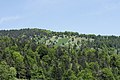
nature
In the south are the Steyr breakthrough and the nature reserve Planwiesen. The Steyrschlucht nature reserve stretches from Agonitz ( Oberleonstein ) to the Haunoldmühle (Obergrünburg).

Steyr Gorge near Molln

Steyr breakthrough
Plan meadows


Individual evidence
- ↑ Willibald Girkinger / Wolfgang Heitzmann: The Steyr. Landscape and people on the river. Linz, Oberösterreichischer Landesverlag 1990, 2nd edition. P. 58 ISBN 3-85214-527-9
- ↑ Willibald Girkinger / Wolfgang Heitzmann: The Steyr. Landscape and people on the river. 1990, p. 20
- ↑ Province of Upper Austria: Steyr and Teichltal: Kurz & Bündig (accessed on March 28, 2020)
- ↑ oegeg.at: Schmalspur (Steyrtalbahn) history , accessed on March 28, 2020
- ↑ Willibald Girkinger / Wolfgang Heitzmann: The Steyr. Landscape and people on the river . 1990, p. 56 (Planwiesen).
- ↑ Plan overview of the "Steyrschlucht" nature reserve (accessed on March 28, 2020)
Web links
Coordinates: 47 ° 54 ' N , 14 ° 14' E