Stongland
| Stongland | ||
| Geographical location | ||
|
|
||
| Coordinates | 69 ° 3 '0 " N , 17 ° 8' 24" E | |
| Waters 1 | Eid pollen , Vågsfjord | |
| Waters 2 | Tranøyfjord | |
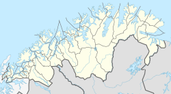
Stongland ( Stonglandet ) is a peninsula in the extreme south of the island Senja in the Norwegian Fylke (province) Troms og Finnmark . Administratively it belongs to the municipality of Senja .
geography
The peninsula has an extension of 9 km from northeast to southwest and 7 km from west to east. It is separated in the north from the main part of the island by the 6 km long fjord Eidepollen, which starts from Vågsfjord in the west and only in the extreme east by the only 350 m wide and 200 m long isthmus Stonglandseid, which separates the Eidepollen from Tranøyfjord in the east Senja connected. The Vågsfjord stretches to the west of the peninsula, and in the south and east the peninsula extends far into the Tranøyfjord.
In the west of the peninsula lies the deeply cut, approximately 3 × 4 km large Hofsøybotn, whose passage to the Vågsfjord is only 70 m wide and is therefore almost an inland lake. The interior of Stongland is mountainous and reaches a height of 301 m in the Stangnesfjell in the southwest and 249 m in the northeast in Leirfjell.
Settlements and infrastructure
The peninsula is populated on its coasts, but only very thinly. The largest town - with around 230 residents as well as a school, church, retirement home and village shop - is Stonglandseid (or simply Eid) on and on the isthmus, which is mostly not on Stongland itself, but north of the isthmus on the main part of Senja. The total number of inhabitants in the remaining settlements on Stongland was 94 in 2011.
The Fv860 provincial road ends in Stonglandseid and leads east along the south bank from Senja to Silsand and to Gisundbrua on the mainland. From Stonglandseid westwards the Fv221 goes on the north bank of the Eidepollen to Skrolsvik, where there is a fast boat connection with Harstad. South of Stonglandseid, the Fv223 go south and a local road goes west to the Stongland peninsula along its coast. On the Fv223 on the east side are the settlements Valvåg on the east coast and Lekangsund at the southeast end, and from there a municipal road goes along the south coast to Stangnes, the southernmost village on Senja. The municipal road from Stonglandseid goes to Hofsøy by the Vågsfjord.
