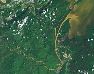
Sungai Limbang
|
Limbang Sungai Limbang |
||
| Data | ||
| location | On Borneo in the state of Sarawak | |
| River system | Sungai Limbang | |
| source | at Bukit Batu Lawi 3 ° 49 ′ 6 " N , 115 ° 25 ′ 29" E |
|
| muzzle | near Pekan Limbang in the Brunei Bay Coordinates: 4 ° 51 ′ 16 " N , 115 ° 1 ′ 11" E 4 ° 51 ′ 16 " N , 115 ° 1 ′ 11" E |
|
| Mouth height |
0 m
|
|
| length | 196 km | |
| Catchment area | 3680 km² | |
| Left tributaries | Sungai Medalam | |
| Right tributaries | Sungai Selidong; Sungai Medamit | |
| Medium-sized cities | Pecan limbang | |
| Small towns | Long Napir | |
| Navigable | Yes | |
The Sungai Limbang (also just Limbang ) is a river on Borneo in Malaysia and Brunei . It forms part of the border between the two states.
geography
The river flows through the Malaysian state of Sarawak and has a length of 211 km. The Limbang rises at Bukit Batu Lawi in the center of Borneo and flows into Brunei Bay in the north of the island . It has a catchment area of 3680 km² and roughly spans the area of the Limbang district . Its main tributaries are the Sungai Medalam from the left and the Sungai Medamit from the right.
The islands include Pulau Berambang , the largest island in Brunei.
ecology
Efforts are currently being made to build dams in the middle reaches of the river. However, this would destroy ancestral settlement areas of indigenous peoples of the Penan and Kelabit , which leads to controversial discussions.
Individual evidence
- ↑ IWMI: PDF page 18
- ↑ Ministry of Natural Reserves and Environment, Malaysia: PDF ( page no longer available , search in web archives ) page 74
- ↑ Archived copy ( Memento of July 3, 2012 in the Internet Archive ) Sarawak Integrated Water Resources Management Master Plan
- ↑ Archived copy ( memento of January 11, 2011 in the Internet Archive ) Dam project endangers rainforest
