Szentendre Island
| Szentendre Island | ||
|---|---|---|
| Northern end of Szentendre Island on the Danube Bend | ||
| Waters | Danube | |
| Geographical location | 47 ° 42 ′ N , 19 ° 6 ′ E | |
|
|
||
| length | 38 km | |
| surface | 56 km² | |
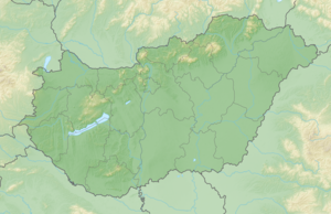
The Szentendre Island ( Hungarian : Szentendrei-sziget , German: Sankt-Andrä-Insel ) is a Hungarian Danube island in Pest County . It separates the narrower western arm of the Danube from the eastern main stream. The island is part of the Duna Ipoly National Park .
Szentendrei has a length of 38 kilometers and an area of 56 square kilometers. The northern end begins just below Visegrád , at the eastern end of the Danube Bend . The island is a popular excursion and recreation area for the capital of Budapest . The town of Szentendre (St. Andrä) lies on the west bank of the western arm of the Danube .
history
St. Andrä was of strategic importance in Roman times, as the Danube was part of the Limes system as the imperial border . With the expansion of the fortifications in late antiquity, during the construction of the Great Barrier System in the Great Hungarian Plain ( Devil's Dykes ) , was among other things to the districts of the municipality Tahitótfalu with Schiffslände Tahitótfalu-Balhavár a Ländeburgus . Other similar Roman bases, such as the Szigetmonostor-Horány bridgehead , several burgi and a small garrison ( Kisoroszi small fort ) are known and have been partially excavated.
structure
At Tahitótfalu is the only bridge that leads from the western bank of the river to the island, the Zoltán-Tildy Bridge. The island can also be reached by ferry from Vác and Dunabogdány . Another district, Tahi, lies on the banks of the Danube at the foot of the Visegráder Mountains , which form the north-eastern end of the Pilis Mountains .
The following towns and districts are located downstream on the island itself:
Remarks
- ↑ Imre Graphics: Szentendre sziget Néprajzi korülhatárolásának kérdése. Problems of ethnographic confines of the island of Szentendre (St. Andrä) . In: Ethnographia 90, (1979), pp. 500-509.
- ↑ Duna-Ipoly National Park , on the pages "Budapest.com"
- ^ Éva Maróti : A Roman building near Szigetmonostor-Horóny. In: Pannonica provincialia et Archaeologica. Festschrift for Jenő Fitz. Hungarian National Museum, Budapest 2003. pp. 203–231.
- ^ Éva Maróti: A Roman building near Szigetmonostor-Horóny. In: Pannonica provincialia et Archaeologica. Festschrift for Jenő Fitz. Hungarian National Museum, Budapest 2003, pp. 197–203; Zsolt Mráv : On the dating of the late Roman ship lands on the border of the province of Valeria ripensis. In: Ádám Szabó , Endre Tóth (ed.): Bölcske. Roman inscriptions and finds. Hungarian National Museum, Budapest 2003, pp. 33–50.
- ^ Zsolt Visy : The ripa Pannonica in Hungary. Akadémiai Kiadó, Budapest 2003, ISBN 9630579804 , pp. 53-54.

