Tabas
| Tabas | ||
|---|---|---|
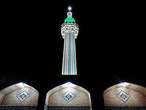
| The Kadhim Shrine | ||
|
|
||
| Basic data | ||
| Country: |
|
|
| Province : | Yazd Province | |
| Coordinates : | 33 ° 35 ′ N , 56 ° 55 ′ E | |
| Height : | 667 m | |
| Residents : | 35,229 (2012) | |
| Time zone : | UTC +3: 30 | |
Tabas ( Persian طبس, DMG Ṭabas ), capital of the Tabas district , is a city with about 35,000 inhabitants, located in the center of Iran , 950 km from Tehran . The city in the province of South Khorasan , which was formerly part of Khorasan Province , is best known for its ancient citrus plants . The oasis city has a magnificent 300 year old public garden, Baghe-golshan , which is especially famous for its fountains .
history
In 1978 the city was struck by a severe earthquake measuring 7.5 to 7.9 on the Richter scale . Around 22,000 people died in Tabas and the surrounding area. Today the city is completely rebuilt after the heavy devastation of that time.
Operation Eagle Claw , which was coordinated to free the American hostages from Tehran , failed near the city in 1980 .
traffic
The town lies on the North-South Railway Iran, the eastern north-south rail link the country from Mashhad to Bandar Abbas . There is a project to build a direct railway line from Tabas to Zahedan . There are flights to Tabas Airport from Tehran .
Individual evidence
- ↑ Page no longer available , search in web archives: World Gazetteer Population Data 2012
- ↑ Islamic Republic of Iran Ministry of Roads and Urban Developement - Deputy for Construction & Developement of Railway, Airport and Ports: [ Map of the Iranian Railway Network]. Status: August 2014.

