Guillermo Cano dam
| Guillermo Cano Dam - San Lorenzo Reservoir - Jaguas Hydroelectric Power Station |
|||||||||
|---|---|---|---|---|---|---|---|---|---|
|
|||||||||
|
|
|||||||||
| Coordinates | 6 ° 22 '43 " N , 74 ° 59' 54" W | ||||||||
| Data on the structure | |||||||||
| Lock type: | Earthfill dam | ||||||||
| Construction time: | 1987 | ||||||||
| Height of the barrier structure : | 63 m | ||||||||
| Power plant output: | 170 MW | ||||||||
| Operator: | ISAGEN | ||||||||
| Data on the reservoir | |||||||||
| Altitude (at congestion destination ) | 1247 m | ||||||||
| Water surface | 10.6 km² | ||||||||
| Reservoir length | 7.8 km | ||||||||
| Storage space | 185.5 million m³ | ||||||||
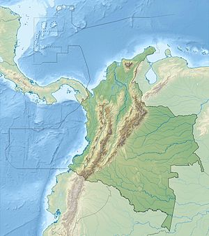
The Guillermo Cano dam (Spanish: Presa Guillermo Cano ) is located in the Antioquia department in central Colombia , 65 km east-northeast of the city of Medellín . The dam was built to generate electricity. The operator of the plant is ISAGEN.
dam
The dam dams the Río Nare almost 10 km north-northeast of the small town of San Rafael . It lies in the east of the Central Cordillera of Colombia. The dam consists of a 63 m high embankment dam . The barrier structure consists of two dam sections with lengths of 660 m and 650 m. In between there is a flood relief system with a weft channel , which, if necessary, directs the water into the river bed of the Río Nare, which has fallen almost dry.
Reservoir
The heavily branched and up to 7.8 km long reservoir San Lorenzo (Spanish Embalse de San Lorenzo ) has a water surface of 10.6 km². It lies at an altitude of about 1247 m . The storage volume is 185.5 million m³. Upstream is the Peñol-Guatapé reservoir on the upper reaches of the Río Nare . Its water is mainly fed to the Guatapé hydropower plant and then reaches the Guatapé River .
Hydroelectric power plant
The hydroelectric power plant Jaguas (span. Central Hidroeléctrica Jaguas ) is a cavern power plant . It consists of 2 units. Each unit has a Francis turbine with an output of 86.7 MW. The fall height is 245 m. The inlet structure is located on the south bank of the reservoir ( ⊙ ). From there the water is fed to the hydropower plant. A water lock ( ⊙ ) ensures pressure equalization. The electricity is fed from the power plant to a nearby above-ground substation ( ⊙ ). The water flows below the power station through a discharge tunnel and finally reaches the north-west bank ( ⊙ ) of the Playas reservoir . The Playas reservoir is located on the Guatapé River.
![]() Map with all coordinates: OSM | WikiMap
Map with all coordinates: OSM | WikiMap
See also
Individual evidence
- ↑ a b c d e f Foro Internacional Corredores de Biodiversidad y Areas Protegidas (PDF, 4.5 MB) Paraguay Biodiversidad. April 2016. Retrieved July 17, 2019.
- ↑ a b c d Central Hidroeléctrica Jaguas . ISAGEN. Retrieved July 17, 2019.
- ↑ APROVECHAMIENTO ACUICOLA DE EMBALSES EN COLOMBIA . Food and Agriculture Organization of the United Nations (FAO). Retrieved July 17, 2019.
