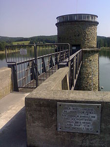
Luhačovice dam
| Luhačovice dam | |||||||||||
|---|---|---|---|---|---|---|---|---|---|---|---|
| eastern part at the confluence of the Šťávnice | |||||||||||
|
|||||||||||
|
|
|||||||||||
| Coordinates | 49 ° 7 '17 " N , 17 ° 46' 26" E | ||||||||||
| Data on the structure | |||||||||||
| Lock type: | Earth embankment dam with clay dam breast | ||||||||||
| Construction time: | 1912-1930 | ||||||||||
| Height above valley floor: | 17.47 m | ||||||||||
| Height of the structure crown: | 286.47 m n. M | ||||||||||
| Crown length: | 240 m | ||||||||||
| Crown width: | 6 m | ||||||||||
| Power plant output: | 0.015-0.027 | ||||||||||
| Operator: | Povodí Moravy, sp | ||||||||||
| Data on the reservoir | |||||||||||
| Altitude (at congestion destination ) | 279.75 m n. M | ||||||||||
| Water surface | 44.87 km² | ||||||||||
| Total storage space : | 2,680,000 m³ | ||||||||||
| View from the top of the dam | |||||||||||
The dam Luhačovice , even dam Pozlovice ( Czech Luhačovická přehrada or Pozlovická přehrada ) is a hydraulic structure in the Czech Republic . It is located six kilometers east of Pozlovice on its corridors and dams the Šťávnice at river kilometer 14.4. The operator is Povodí Moravy sp - závod Střední Morava. It is used for flood protection, recreation, fishing and energy generation.
geography
The dam is located at the transition between the White Carpathians and the Vizovice Mountains in the area of the protected landscape area CHKO Bílé Karpaty in the Šťávnice valley. To the northeast rises the Plaňavka (381 m), in the east the Kameničná (521 m), south the Obětová (511 m), in the southwest the Jestřabí hora and Obora (386 m) and northwest the Větrník (432 m).
Surrounding villages are Podhradí , Na Nivce and Sedlářův Mlýn in the north, Martincův Mlýn and Dolní Lhota in the north-east, Na Klenkově, Řezníček and Lazy in the east, Nevšová and Petrůvka in the south-east, Ještí and Kladná Žilín in the south, Pražviva č in the south West and Pozlovice in the northwest.
history
The first plans to build a dam to protect the Luhačovice spa were made after the catastrophic floods of September 1910. The kk government and the Moravian provincial government selected the largely uninhabited valley above the Prague quarter, in which the river flows to the confluence, as a suitable location Baches Petrůvka with the Rudolph mill and the Podobětovský mill were only two mills.
The aim was to reduce the amount of water flowing through from 72 m³ / s to 33 m³ / s in the event of another flood. It should therefore have a backwater volume of 1,125,000 m³. A storage space of 600,000 m³ was provided as a reservoir to regulate the water level in the Šťávnice and Olšava in drought years. The reservoir should have a total of 2,025,000 m³ and an area of 45.5 km².
Construction work began in the summer of 1912. After the outbreak of the First World War, the work was stopped. After the end of the war, the whole project was revised again and construction finally resumed in autumn 1921. In 1930 the dam was finally completed.


