Olšava (March)
| Olšava | ||
|
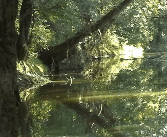
Old river bed near Uherský Brod |
||
| Data | ||
| location | Jihomoravský kraj ( Czech Republic ) | |
| River system | Danube | |
| Drain over | March → Danube → Black Sea | |
| source | At Na Koncích in the White Carpathians 49 ° 1 ′ 9 ″ N , 17 ° 54 ′ 50 ″ E |
|
| Source height | 622.2 m nm | |
| muzzle | Opposite Kostelany nad Moravou in the March coordinates: 49 ° 2 ′ 51 ″ N , 17 ° 24 ′ 57 ″ E 49 ° 2 ′ 51 ″ N , 17 ° 24 ′ 57 ″ E |
|
| Mouth height | 177 m nm | |
| Height difference | 445.2 m | |
| Bottom slope | 9.9 ‰ | |
| length | 44.9 km | |
| Catchment area | 520.53 km² | |
| Drain |
MQ |
2.14 m³ / s |
| Small towns | Bojkovice , Uherský Brod , Kunovice | |
The Olšava ( German Olsawa ) is a left tributary of the March in the Czech Republic .
geography
The Olšava rises on the northwest slope of the Na Koncích mountain ( 652 m ) in the White Carpathians . It flows first over V Podlesí, Pitín and Bojkovice to the northwest.
From Bojkovice the river changes its course to the west. Záhorovice , Nezdenice and Šumice follow along the Olšava . The Olšava then enters the Moravian Plain and via Újezdec, Těšov, Uherský Brod , Havřice, Drslavice , Lhotka, Hradčovice , Veletiny , Podolí , Popovice , Míkovice, Vésky and Sady it reaches Kunovice . Your further course leads south past Uherské Hradiště . Opposite Kostelany nad Moravou , the Olšava flows into the March after 44.9 km. Its catchment area is 530.53 km².
The Brno – Vlárský průsmyk railway follows the course of the river between Pitín and Kunovice . The European route 50 / state route I / 50 also runs along the Olšava on the Uherský Brod - Kunovice section .
A section of the river near Podolí is protected as a nature reserve Olšava. To the south of the estuary is the Tůň u Kostelan nature reserve, a thrown meander of the March.
Originally, the Olšava forked into two estuary arms near Sady. The right arm of the river flowed into the March at Uherské Hradiště. This arm, the Stará Olšava, is now a thrown trench.
In the second half of the 20th century, the course of the river was regulated, in which the natural river bed was largely destroyed by straightening.
Tributaries
- Vlčí potok (l), V Podlesí
- Suchý potok (l), V Podlesí
- Kolelač (r), Bojkovice
- Komenka (l), Bojkovice
- Kladenka (r), Nezdenice
- Ovčírka (r), Šumice
- Ledský potok (l), Šumice
- Luhačovický potok (r), Újezdec
- Horenůšek (r), Újezdec
- Bánovský potok (l), above Uherský Brod
- Nivnička (l), Uherský Brod
- Chřástka (l), near Havřice
- Havřický potok (r), Havřice
- Holomňa (r), Drslavice
- Hradčovický potok (r), Hradčovice
- Vlčnovský potok (l), Veletiny
- Hraniční potok (l), below Veletiny
- Podolský potok (l), above Podolí
- Olšovec (r), Vésky
- Míkovický potok (l), Míkovice
Web links
- Description on dibavod.cz ( TIFF format)
