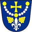
Popovice u Uherského Hradiště
| Popovice | ||||
|---|---|---|---|---|
|
||||
| Basic data | ||||
| State : |
|
|||
| Region : | Zlínský kraj | |||
| District : | Uherské Hradiště | |||
| Area : | 859 ha | |||
| Geographic location : | 49 ° 3 ' N , 17 ° 32' E | |||
| Height: | 263 m nm | |||
| Residents : | 1,027 (Jan 1, 2019) | |||
| Postal code : | 686 04 | |||
| License plate : | Z | |||
| traffic | ||||
| Street: | Podolí - Popovice | |||
| Railway connection: | Brno – Vlárský průsmyk | |||
| structure | ||||
| Status: | local community | |||
| Districts: | 1 | |||
| administration | ||||
| Mayor : | Jitka Nováková (as of 2010) | |||
| Address: | Popovice 303 686 04 Kunovice |
|||
| Municipality number: | 592528 | |||
| Website : | www.popovice.cz | |||
Popovice (German Popowitz , formerly Poppowitz ) is a municipality in the Czech Republic . It is located six kilometers southeast of Uherské Hradiště and belongs to the Okres Uherské Hradiště .
geography
Popovice is located on the right side above the Olšava valley . The village is located in the Prakšická pahorkatina hills belonging to the Vizovická vrchovina on the edge of the nature park of the same name. To the west lies the valley of the Olšovec brook with the Popovické rybníky ponds. The Lovisko (349 m) rises to the northeast, the Milonín (323 m) to the east, the Myšince (352 m) to the southeast, the Kamenný (348 m) and Hluboček (351 m) to the south and the Rovnina (336 m) to the northwest. The Brno – Vlárský průsmyk railway runs south of the village in the Olšava valley , followed by the European route 50 / state road I / 50 from Brno to Trenčín .
Neighboring towns are Javorovec and Mistřice in the north, Nedachlebice and Prakšice in the northeast, Hradčovice in the east, Veletiny in the southeast, Podolí in the south, Míkovice and Vésky in the southwest, Sady in the west and Mařatice, Rybárny and Jarošov in the northwest.
history
The first written mention of Horní Popovice took place in 1220 when the village was donated by Ottokar I Přemysl to the Cistercian order. In 1228 the village was listed together with Dolní Popovice in the founding deed of the Velehrad monastery as a monastery property. Allegedly, Ulrich III. von Spanheim donated a chapel of the Virgin Mary in Popovice on the hill near Kunovice to the monastery in 1247. Today this is regarded as wrong, since at that time the goods already belonged to the monastery. After the destruction of the monastery by the Hussites , Burian von Vlčnov took possession of the property. In 1437 Burian Popovice received a pledge. In 1467, the monastery pledged the villages of Podolí and Popovice to the town of Hradiště for 20 years . Eventually the Popovice Monastery sold to the city on June 28, 1533. In 1669 the whole village was burned down when the Hungarians invaded. With further incursions by Hungarian troops, Popovice was again partially set on fire in 1683. The oldest local seal dates from 1698. In 1708 a trivial school was established in Popovice, before teaching was carried out in Derfle. In the middle of the 18th century the village had about 500 inhabitants. In 1828 a school was built in Popovice. Until the middle of the 19th century Popovice always remained subordinate to the Uherské Hradiště estate.
After the abolition of patrimonial Popovice / Poppowitz formed from 1850 a community in the Hungarian Hradisch district . During the German War in 1866, Prussian troops brought in cholera , which caused 31 residents to die. In 1888 the Wlara Railway was built and a stop was set up in Popovice. Until the establishment of the parish in 1913 Popovice was parish after Derfle. Since then Popovice has also been the parish for Podolí. In 1920 a trade school was established in Popovice. The local distillery was nationalized in 1948.
Community structure
No districts are shown for the municipality of Popovice.
Attractions
- Parish Church of Maria Rosenkranz, built in 1937
- Niche chapel of St. John of Nepomuk, on the dirt road to Hradčovice, built in 1857
- Popovice Christmas Mountain ( Popovický betlém ), the folk art work completed by Antonín Potomák in 1950, is now in the church and is shown at Christmas time
- Museum of Folk Costumes of the Potomák Family ( Potomákovo muzeum lidových krojů ), opened in 2007
- The Chapel of Our Lady of the Rosary by a miraculous spring in the Kříb corridor near Popovické rybníky, built in the first half of the 20th century
- Observation tower on the Rovnina, the 49.5 m high transmission tower by EUROTEL Praha built between 2001 and 2003 was provided with an observation platform at a height of 23.93 m.
- Prakšická pahorkatina nature park
- Olšava nature reserve, uneven section of the Olšava river, south of the village

