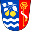
Babice u Uherského Hradiště
| Babice | ||||
|---|---|---|---|---|
|
||||
| Basic data | ||||
| State : |
|
|||
| Region : | Zlínský kraj | |||
| District : | Uherské Hradiště | |||
| Area : | 661 ha | |||
| Geographic location : | 49 ° 7 ' N , 17 ° 29' E | |||
| Height: | 183 m nm | |||
| Residents : | 1,832 (Jan 1, 2019) | |||
| Postal code : | 687 03 | |||
| License plate : | Z | |||
| traffic | ||||
| Street: | Uherské Hradiště - Otrokovice | |||
| structure | ||||
| Status: | local community | |||
| Districts: | 1 | |||
| administration | ||||
| Mayor : | Mgr. Martina Horňáková (as of 2020) | |||
| Address: | Babice 508 687 03 Babice u Uherského Hradiště |
|||
| Municipality number: | 592013 | |||
| Website : | babice.eu | |||
Babice (German Babitz ) is a municipality in the Okres Uherské Hradiště in the Czech Republic . It is located six kilometers north of Uherské Hradiště and belongs to the Zlínský kraj region .
history
Babice was first mentioned in writing in 1220. It was originally an old trading settlement that belonged to the Velehrad monastery . After the First World War, a company for the production of jam was founded in the village , which later expanded its production to include the production of liqueurs, distillates and vinegar. The first floating bucket excavator was built in Fabian Valenta's workshop in 1928. Nevertheless, Babice remained a place with fruit growing mainly dependent on agriculture.
Community structure
No districts are shown for the Babice community. The settlement Cerony ( Zeronin ) belongs to Babice .
Attractions
Individual evidence
- ↑ Český statistický úřad - The population of the Czech municipalities as of January 1, 2019 (PDF; 7.4 MiB)

