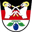
Dolní Lhota u Luhačovic
| Dolní Lhota | ||||
|---|---|---|---|---|
|
||||
| Basic data | ||||
| State : |
|
|||
| Region : | Zlínský kraj | |||
| District : | Zlín | |||
| Geographic location : | 49 ° 8 ' N , 17 ° 49' E | |||
| Height: | 299 m nm | |||
| Residents : | 655 (Jan. 1, 2019) | |||
| Postal code : | 763 23 | |||
| License plate : | Z | |||
| traffic | ||||
| Street: | Luhačovice - Vizovice | |||
| structure | ||||
| Districts: | 1 | |||
| administration | ||||
| Mayor : | Jaroslav Masař (as of 2006) | |||
| Address: | Dolní Lhota 129 76323 Dolní Lhota u Luhačovic |
|||
| Municipality number: | 585173 | |||
| Website : | www.dolni-lhota.cz | |||
Dolní Lhota is a municipality in the Czech Republic . It is located ten kilometers southwest of Vizovice and belongs to the Okres Zlín .
geography
Dolní Lhota is located at the transition between the White Carpathians and the Vizovice Mountains on the edge of the protected landscape area CHKO Bílé Karpaty. The village is located in the south of Moravian Wallachia in the Šťávnice valley . Towards the southwest is the Luhačovice dam .
history
Several German names have been found for the place: Unter-Lhota (1869, 1888), Unterlhotta (1900, 1910), Unter-Lhotta (1939). From 1964 the place was united with the neighboring municipality Horní Lhota to Lhota u Luhačovic . Already at the end of the 19th century all residents were of Moravian nationality.
Attractions
- Farmhouse with mill building
Web links
Commons : Dolní Lhota u Luhačovic - collection of pictures, videos and audio files
Remarks
- ↑ Český statistický úřad - The population of the Czech municipalities as of January 1, 2019 (PDF; 7.4 MiB)
- ↑ Bartoš, Josef, Jindřich Schulz and Miloš Trapl: Historický místopis Moravy a Slezska v letech 1848-1960. Volume 7: Okresy. Valašské Meziříčí, Vsetín, Holešov, Gottwaldov (Zlín). Profil, Ostrava 1980, p. 228 f.

