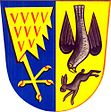
Jestřabí
| Jestřabí | ||||
|---|---|---|---|---|
|
||||
| Basic data | ||||
| State : |
|
|||
| Region : | Zlínský kraj | |||
| District : | Zlín | |||
| Area : | 389 ha | |||
| Geographic location : | 49 ° 4 ′ N , 17 ° 57 ′ E | |||
| Height: | 336 m nm | |||
| Residents : | 277 (Jan. 1, 2019) | |||
| Postal code : | 763 33 | |||
| License plate : | Z | |||
| traffic | ||||
| Street: | Slavičín - Brumov-Bylnice | |||
| Railway connection: | Brno – Vlárský průsmyk | |||
| structure | ||||
| Status: | local community | |||
| Districts: | 1 | |||
| administration | ||||
| Mayor : | Pavel Šuráň (as of 2010) | |||
| Address: | Jestřabí 1 763 33 Štítná nad Vláří |
|||
| Municipality number: | 585319 | |||
| Website : | www.jestrabi.estranky.cz | |||
Jestřabí (German: Jastraby , 1939–1945 Habichtsau ) is a municipality in the Czech Republic . It is located six kilometers southeast of Slavičín and belongs to the Okres Zlín .
geography
Jestřabí is located in the northwest of the White Carpathians in the area of the CHKO Bílé Karpaty Nature Park. The village lies below the confluence of the Rokytenka in a right side valley of the Vlára. To the north rise the Stupně (490 m) and the Rubanisko (501 m), east the Brálové, in the northeast the Lázek (399 m), southeast the Na Nivách (512 m), in the south the Doubrava (520 m), southwest the Rovně (435 m) and the Vrchy (461 m) in the north-west. There is a transmission tower on Na Nivách. The Wlara Railway runs north of the village along the Vlára , the nearest railway station is Popov .
Neighboring towns are Vrbětice and Křekov in the north, Popov in the Northeast, Štítná nad Vláří the east, Žírce, Salašisko, Vápenice and Kršlisko the southeast, Velíková, SEBAK, Valentová and cooking Avec in the south, jabłoni, Podsedky, Šanov and Pod Zbytkem in the southwest, Rokytnice and Hrádek na Vlárské dráze in the west and Rokytenka, Divnice and Bohuslavice nad Vláří in the northwest.
history
The first written mention of the village took place in 1503. The fortress Jestřabí formed at that time a legacy of the Brumov castle , whose owner was Jan Flajh from Jestřabí. The name of the village is derived from jestřáb ( hawk ). In 1520 the village was called Gestrzebij , 1571 Gestrzaby , 1671 Jestržaby and 1720 Jestrzabi . The place originally belonged to the Olomouc district and after its division in 1637 to the Hradic district. Since 1787 there was a locality and parish school in Jestrzabi, previously the village was parish to Brumov. Until the middle of the 19th century, Jestřaby remained subject to the Brumov rule.
After the abolition of patrimonial Jestřabí formed from 1850 a municipality in the district administration Uherský Brod and the judicial district Valašské Klobouky . Between 1855 and 1866 the village was assigned to the Valašske Klobouky District and then came back to the re-established Uherský Brod District Commission. The locality Štítná nad Vláří was raised to a parish in 1856, Jestřabí and Popov were from then on parish there. After the cancellation of the Okres Valašské Klobouky, Jestřabí came to the Okres Gottwaldov in late 1960 . Between 1976 and 1991 Jestřabí was incorporated into Štítná nad Vláří-Popov . The settlement of Kochavec was separated from the Jestřabí cadastre in 1976 and added to Rokytnice. Since the beginning of 1992 Jestřabí has formed its own municipality.
Community structure
No districts are shown for the municipality of Jestřabí. The settlements Rokytenka and Velíková belong to Jestřabí.
Attractions
- Chapel of the Virgin Mary Svatohostýnská, it was built between 1922 and 1927 with the support of American emigrants in place of a wooden bell tower
- Stone crucifix on the village green, erected in 1906

