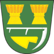
Tichov
| Tichov | ||||
|---|---|---|---|---|
|
||||
| Basic data | ||||
| State : |
|
|||
| Region : | Zlínský kraj | |||
| District : | Zlín | |||
| Area : | 732 ha | |||
| Geographic location : | 49 ° 11 ' N , 17 ° 59' E | |||
| Height: | 466 m nm | |||
| Residents : | 312 (Jan. 1, 2019) | |||
| Postal code : | 766 01 | |||
| License plate : | Z | |||
| traffic | ||||
| Street: | Valašské Klobouky - Drnovice | |||
| structure | ||||
| Status: | local community | |||
| Districts: | 1 | |||
| administration | ||||
| Mayor : | Josef Slovák (as of 2010) | |||
| Address: | Tichov 48 766 01 Valašské Klobouky |
|||
| Municipality number: | 535184 | |||
| Website : | www.tichov.cz | |||
Tichov , until 1924 Cichov (German Zichow ) is a municipality in the Czech Republic . It is located five kilometers north of Valašské Klobouky in Moravian Wallachia and belongs to the Okres Zlín .
geography
Tichov is located at the southeastern foot of the Vizovická vrchovina at the transition to the Javorníky in the valley of the Tichovský creek. The Bařinka (716 m) and Vrátnice (680 m) rise to the north, the Příčné (569 m) to the northeast, the Orla (502 m) to the east, the Hrušové (498 m) to the south, and the Humenec (510 m) to the west in the northwest of the Klašťov (753 m), Svěradov (737 m) and the Hůrka (634 m).
Neighboring towns are Sochorák, Podhoří, Juric, Váša, Vařákovy Paseky, Pozděchov , Valašská Polanka and Lužná in the north, Račné and Lidečko in the Northeast, U Janků and Lačnov the east, Poteč the southeast, Smolina, Veliké, Mirošov and Díly in the south, Vlachova Lhota , Pod Polem and Vrchy in the southwest, Drnovice and Vysoké Pole in the west and Ploština and Osičí in the northwest.
history
Archaeological finds prove an early settlement of the community area. A burial place of the urn field culture was found in the Stráže corridor .
The first written mention of the Pasekaren settlement Cichov , which belongs to Brumov Castle , was made in 1422 as a pledge of King Sigismund's . Other owners included the Lords of Cimburg between 1441 and 1468 , the Podmanický of Podmanín between 1474 and 1515 and, from 1519, the Lords of Lomnitz. After the death of Jaroslav von Lomnitz in 1572, his sister Magdalena inherited the rule. She was the wife of Henry III. von Münsterberg and sold the Brumov Castle with all its accessories, including Czichow , to Zdeněk Říčanský Kavka from Říčany in 1574. The Kavka von Říčany held the property until 1622. Between 1626 and 1662 the Counts Forgács owned the property. In 1629 a fire destroyed a large part of the village. In the course of the 17th and 18th centuries, five salash taverns were built . In 1663 the Turks burned 14 houses and murdered one resident; They also drove away two horses, 14 cattle and 361 sheep. In 1670 the place was called Czichlow . Before the Kuruc the residents at the beginning of the 18th century in the forest Úprzla hid. After the division of rule, the village fell to the First Lordship of Brumow, which belonged to Count Illyesházy . The spelling Cžzhlow has been handed down from 1751 . In 1758 the village consisted of 43 properties and a stately smithy. In 1790 about 300 people lived in the place. Teaching has been taking place in the village since the beginning of the 19th century. The Count Illyesházy held Brumov I until 1835, after which Georg Simon von Sina bought the property. In 1846 the place was called Čichow or Čychow, formerly Těchov . Tichov always remained agricultural and was always subject to Brumov I until the middle of the 19th century. The place has always been parish after Valašské Klobouky.
After the replacement of patrimonial Čichow / Zichow formed from 1850 a municipality in the district administration Uherský Brod . In 1866 cholera broke out. In 1868 the entire village, consisting of wooden houses, burned down. From 1872 the community was called Cichow and from 1881 Cichov . In 1898 the first own school building was built in the community. Cichov had about 450 inhabitants in 1900. In 1924 the village was named Tichov, formerly Cichov . Five residents of Tichov were among the victims of the Ploština massacre on April 19, 1945. In 1949 the community was assigned to the Okres Valašské Klobouky. In 1950 Tichov reached its highest population with 560 inhabitants. During the regional reform of 1960, the place came to Okres Gottwaldov . In 1980 Tichov was incorporated into Valašské Klobouky , and since January 1, 1993 Tichov has again formed its own municipality.
Attractions
- Chapel of Christ the King, the building, approved in 1938, could not be completed until 1947–1948 due to the Second World War. In the chapel there is also a memorial plaque for the five inhabitants of the village who were burned in Ploština.


