Troneras dam
| Troneras dam Represa Troneras |
|||||||||||
|---|---|---|---|---|---|---|---|---|---|---|---|
|
|||||||||||
|
|
|||||||||||
| Coordinates | 6 ° 46 '47 " N , 75 ° 15' 6" W | ||||||||||
| Data on the structure | |||||||||||
| Construction time: | -1964 | ||||||||||
| Power plant output: | 40 MW | ||||||||||
| Operator: | Empresas Públicas de Medellín (EPM) | ||||||||||
| Data on the reservoir | |||||||||||
| Altitude (at congestion destination ) | 1770 m | ||||||||||
| Reservoir length | 6.5 km | ||||||||||
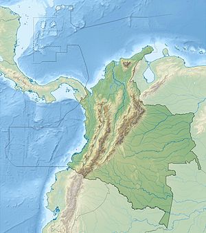
The Troneras Dam (Spanish Represa Troneras ) is located on the Guadalupe River , a left tributary of the Porce River , in central northern Colombia . The dam is located in the Colombian Central Cordillera 65 km northeast of the city of Medellín in the Department of Antioquia .
The Río Guadalupe is dammed north of the municipality of Carolina del Príncipe over a length of 6.5 km. The reservoir, located at an altitude of around 1770 m , also receives water from the Miraflores dam , which is located further to the west and is located in the catchment area of the upper reaches of the Río Nechí . The dam has a flood relief system. There is a hydroelectric power station below the dam. The water drives two vertically directed Francis turbines with an output of 20 MW each. The first power plant unit went into operation in 1964, the second a year later. The average annual energy production is 242 GWh. The system is operated by Empresas Públicas de Medellín (EPM). Downstream are the two hydropower plants Guadalupe III and Guadalupe IV .
Individual evidence
- ↑ a b c d System de generación de energía de EPM . EPM. Retrieved July 27, 2019.

