Tanjung Pinang
| Tanjung Pinang | |
|---|---|
| Basic data | |
| State : | Indonesia |
| Province : | Kepulauan Riau |
| Coordinates : | 0 ° 55 ' N , 104 ° 27' E |
| Area : | 812.7 km² |
| Residents : | 192,000 |
| Population density : | 236 inhabitants / km² |
| Official Website: | www.tanjungpinangkota.go.id |
| politics | |
| mayor | Hj. Dra. Suryatati A. Manan |
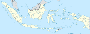
Tanjung Pinang on the map of Indonesia |
Tanjung Pinang is the capital of the Indonesian province of Kepulauan Riau . The city has over 192,000 inhabitants.
geography
The city is located on the west of the south coast of the island of Bintan , on the Riau Strait that separates Bintan from the neighboring island of Rempang . Much of the old town is built on stilts in the sea.
The island is divided into four districts ( Kecamatan ):
- Bukit Bestari
- Tanjung Pinang
- Tanjung Pinang Kota
- Tanjung Pinang Barat
history
In 1941, at the beginning of the Japanese invasion of Southeast Asia , the Dutch armed forces KNIL had only a small garrison under Major JH de Vries stationed in the city . When the Japanese approached, she withdrew to Australia .
traffic
The commercial port is an important hub in traffic between the islands in the province. Ferries go to the neighboring islands of Rempang and Batam , to the more distant islands of Singkep and Kundur , but also to Singapore (duration: 1 hour) and Jakarta (duration: 1 day).
Sons and daughters
The pharmacist Coenraad van Zijp was born on the island in 1879 .
