Tashi Lapcha
| Tashi Lapcha | |||
|---|---|---|---|
|
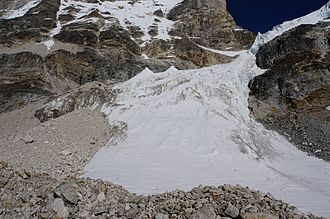
Tashi Laptsa from the west |
|||
| Compass direction | east | west | |
| Pass height | 5750 m | ||
| District | Dolakha | Solukhumbu | |
| Watershed | Tama Koshi | Bothe Koshi | |
| Valley locations | Conditional | Thame or Namche Bazar | |
| expansion | High mountain crossing, not a developed path | ||
| Mountains | Himalayas | ||
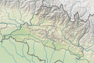
| Map (Bagmati) | |||
|
|
|||
| Coordinates | 27 ° 51 '0 " N , 86 ° 32' 0" E | ||
The Tashi Lapcha is a 5750 m high mountain pass in the Nepalese part of the Himalayas, which represents the transition between the Rolwaling Himal and the Solu-Khumbu or Everest region. The form of the name “Trashi Laptsa” can also be found in alpine literature. To the north is the Tengi Ragi Tau summit , south of the Parchamo trekking summit , which is often climbed as part of the pass crossing. In an easterly direction just below the top of the pass there is a bivouac on a rock wall, somewhat sheltered from the wind.
The pass is comparatively seldom, mostly as part of a Rolwaling trekking tour from the Rolwaling Himal to the Sagarmatha National Park . There are no lodges in the immediate vicinity of the pass on either side, so camping equipment is required for its ascent.
The Tashi Lapcha is one of the more difficult high mountain passes in Nepal due to its height and the difficulty of the approaches. Coming from the west side, the transition between Trakarding Glacier and the higher Drolambaogletscher has to be mastered. While it was still an icefall around 1980, the Drolambau Glacier was completely torn off or melted in 2016 at a height of around 5,100 m and it is a steep rock / scree passage with individual, short climbing points in the 2nd and 3rd degree. Degree (made easier by fixed ropes). From the Drolambaogletscher to the top of the pass, short ice passages of up to 45 degrees have to be walked on, or those to the north about 35-40 degrees steep in the block terrain or rubble. From the east side, a vertical glacier break off north of the pass has to be avoided and there a scree or firn ramp with a steepness of about 45 degrees has to be overcome (about 50 meters in altitude). Crampons and fixed ropes are usually required.
The last accommodation on the western side (Rolwaling) is Na or the Checuma Glacier Camp south of Tsho Rolpa Lake, the last accommodation on the eastern (Khumbu) side is in Thyangbo or the uncultivated Ngole Camp. In autumn 2019, the David Lama Bivouac was built at an altitude of 5080 m between the Trakarding and Drolambao glaciers.


