Thar (English Channel)
| Thar | ||
|
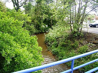
The river at Jullouville |
||
| Data | ||
| Water code | FR : I77-0400 | |
| location | France , Normandy region | |
| River system | Thar | |
| source | on the municipal boundary of La Mouche and Le Tanu 48 ° 47 ′ 39 ″ N , 1 ° 20 ′ 6 ″ W |
|
| Source height | approx. 100 m | |
| muzzle | south of Saint-Pair-sur-Mer in the English Channel Coordinates: 48 ° 48 ′ 18 ″ N , 1 ° 34 ′ 13 ″ W 48 ° 48 ′ 18 ″ N , 1 ° 34 ′ 13 ″ W |
|
| Mouth height | 0 m | |
| Height difference | approx. 100 m | |
| Bottom slope | approx. 4 ‰ | |
| length | 25 km | |
| Catchment area | 85 km² | |
| Left tributaries | Allemagne | |
| Flowing lakes | Mare de Bouillon | |
The Thar is a coastal river in France that runs in the Manche department in the Normandy region . It rises near the hamlet of Noirpalu , on the municipal boundary of La Mouche and Le Tanu , generally drains in a westerly direction, makes a hook to the north just before its mouth, and after 25 kilometers it flows just south of Saint-Pair-sur-Mer in the Gulf of Saint Malo in the English Channel .
Places on the river
(Order in flow direction)
- La Haye Pesnel
- Jullouville
- Kairon Plage , municipality of Saint-Pair-sur-Mer
Individual evidence
- ↑ Source geoportail.gouv.fr
- ↑ estuary geoportail.gouv.fr
- ↑ a b c The information on the length of the river is based on the information about the Thar at SANDRE (French), accessed on March 1, 2013, rounded to full kilometers.
