Thorong La
| Thorong La | |||
|---|---|---|---|
|
Saddle a little below the Thorong La at about 5250 m |
|||
| Compass direction | east | west | |
| Pass height | 5416 m | ||
| District | Manang | mustang | |
| Watershed | Jharsang Khola → Marsyangdi → Kali Gandaki → Ganges | Jhong Khola → Kali Gandaki → Ganges | |
| Valley locations | Muktinath | ||
| expansion | Mountain path | ||
| Mountains | Himalayas | ||
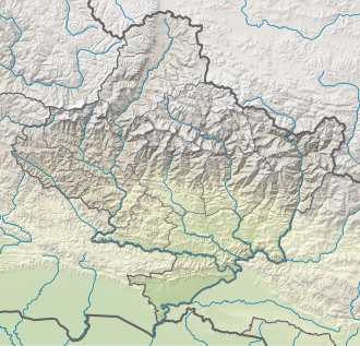
| Map (Gandaki) | |||
|
|
|||
| Coordinates | 28 ° 47 '37 " N , 83 ° 56' 14" E | ||
The Thorong La (also Thorung La or Throng La , German "Donnerpass") is a high mountain pass ( 5416 m ) in the Damodar Himal north of the Annapurna range in Nepal .
The Thorong La is popular with locals as well as trekkers as it is the easiest connection between the two main valleys of the Annapurna area. It is also of particular importance as the geographically highest point of the Annapurna circuit, the Annapurna Circuit , a trek around the Annapurna chain that usually takes about two to three weeks and is one of the most beautiful and varied trekking routes in the world.
The best times to cross the pass are: from the second half of March until well into May and in the high season from around mid-September to around the end of November. At other times you have to be more prepared for adversities such as fog, deep snow (danger of avalanches) and extreme cold. Depending on the previous weather conditions, the pass can be (almost) snow-free and easy to cross; on the other hand, when trying to cross the pass in poor conditions, frostbite and worse occurred.
Every year trekkers as well as Nepalese porters die on this pass - mainly from acute altitude sickness , which results almost exclusively from poor acclimatization. Due to the better acclimatization possibilities and the correspondingly high-altitude fixed overnight accommodation, the crossing of the pass is much more frequent from east to west than the other way around. An ascent from the west side, i.e. from the Kali Gandaki valley, is less recommended due to the greater difference in altitude between the permanent overnight stays in Muktinath at around 3800 m and the pass. A good acclimatization is therefore much better guaranteed for someone who wants to do the Annapurna circumnavigation in the typical time from the east.
The base camp (actually a small village ) on the east side of the pass is called Thorong Phedi and is located at about 4440 m . From there you need about an hour (about 400 meters in altitude) to Thorong Phedi High Camp with the last overnight stay. A well acclimatized trekker needs between three and five hours (about 530 meters in altitude) to walk from Thorong Phedi High Camp to the pass. It is possible to rent a porter or horse up to the top of the pass in Thorong Phedi or Muktinath . The descent from the pass to Muktinath takes between three and five hours, depending on the condition of the path. As early as November and well into March, Thorong La can be icy in some places, so it is necessary to walk carefully, especially on the descent.
Above the Thorong Phedi High Camp there is a seasonally open primitive tea house at an altitude of approx. 5000 m , another, tiny hut exists directly on the top of the pass. In both of them you cannot stay overnight at all or only in an emergency.
It should be emphasized that crossing the Thorong La is technically harmless under normal weather conditions (you never have to touch the rock). The only realistic objective danger is the crossing of a 50 m wide rockfall area about an hour before Thorong Phedi (the valley base on the east side) at about 4000 m.
Disaster on October 14, 2014
An extension of the tropical cyclone Hudhud caused an unexpected, extraordinary onset of winter and a blizzard on October 14, 2014 , especially on the west side of Thorong La. More than 300 people were rescued by local security forces using helicopters, the number of deaths was given as 43 and the number of injuries as 175. On October 19, 45 people were still missing.
Web links
literature
- Bezruchka, Steven, Trekking Nepal: A Traveller's Guide. Mountaineers Books, Seattle 2011, ISBN 978-0898866131 .
Individual evidence
- ↑ Steven Bezruchka: Trekking Nepal: A Traveller's Guide. Mountaineers Books, Seattle 2011, ISBN 978-0898866131 , p. 141
- ↑ rls / dpa: Deadly snowstorm on Annapurna: Dozens are still stuck in the Himalayas. Spiegel Online , October 17, 2014, accessed October 18, 2014 .
- ↑ Patrick Sawer: Nepal trekking disaster: Britons still 'missing' after severe snow storm. Telegraph, October 19, 2014, accessed October 19, 2014 .


