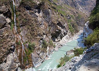
Marsyangdi
| Marsyangdi | ||
| Data | ||
| location | Districts Manang , Lamjung , Tanahu , Gorkha ( Nepal ) | |
| River system | Ganges | |
| Drain over | Trishuli → Gandak → Ganges → Indian Ocean | |
| Headwaters | North flank of Annapurna ( Himalaya ) 28 ° 40 ′ 11 ″ N , 84 ° 0 ′ 22 ″ E |
|
| Source height | approx. 5500 m | |
| muzzle | at Mugling in the Trishuli coordinates: 27 ° 30 ′ 46 ″ N , 84 ° 20 ′ 0 ″ E 27 ° 30 ′ 46 ″ N , 84 ° 20 ′ 0 ″ E |
|
| Mouth height | 244 m | |
| Height difference | approx. 5256 m | |
| Bottom slope | approx. 35 ‰ | |
| length | approx. 150 km | |
| Catchment area | 3850 km² (according to other sources: 4805 km²) | |
| Discharge at the Marsyangdi hydroelectric power station A Eo : 3850 km² |
MQ Mq |
210 m³ / s 54.5 l / (s km²) |
| Left tributaries | Dordi , Chepe , Daraudi | |
| Right tributaries | Paudi Khola | |
| Small towns | Besisahar | |
| Communities | Manang , Pisang , Chame | |
|
Union of the two source rivers of the Marsyangdi |
||
|
Hydroelectric power station on the central reaches of the Marsyangdi |
||
The Marsyangdi ( Nepali : मर्स्याङ्दी , marsyāṅdī ) is a river in central Nepal .
It has a length of about 150 km, rises in the northeast of the Annapurna massif at an altitude of about 3600 m with the two source rivers Khangsar Khola and Thorong Khola (also Jharsang Khola ) and flows into the Trishuli at Mugling . The river flows around the east side of the Annapurna massif through the districts of Manang and Lamjung and separates it from the Manaslu massif . The valley of the Marsyangi is followed by part of the Annapurna circular route ( Annapurna Circuit ) and the Manaslu circular route ( Manaslu Circuit ).
The largest town on the Marsyangdi is Besisahar ( 780 m ). Other well-known places are Manang ( 3550 m ), Pisang ( 3300 m ) and Chame ( 2700 m ).
Hydropower
On the lower reaches of the Marsyangdi near Ambukhaireni ( 348 m ⊙ ) an 89 MW hydropower plant was built in 1990. The water is dammed up and fed through a tunnel to the turbine works ( 280 m ⊙ ) 13 km downstream, which means that almost all of the water is withdrawn from the river in the dry season (September to June) on this stretch.
A second power plant ( Middle Marsyangdi HEP ; 70 MW) was built in 2009 on the middle reaches about 6 km south of Besisahar ( 610 m ), which works on the same principle; the inlet is 7.7 km downstream ( 534 m ⊙ ). The power plant has to be shut down frequently because the river does not carry enough water in the dry season.
A third power plant ( Upper Marsyangdi-2 HEP ; run-of-river power plant with 600 MW) is currently being built on the border of the Manang and Lamjung districts . The project should be completed in 2016. It comprises a 145 m long and 31 m high earth embankment ( ⊙ ). The design flood is 4066 m³ / s. A 9.2 km long headrace tunnel with a diameter of 6 m leads the water to the power plant (4 units of 150 MW each). The height of fall is 627.67 m.
leisure
The Marsyangdi is one of the more well-known rivers for white water descents ( kayaking and rafting ) with levels of difficulty from 4+ to 5-.
Web links
Individual evidence
- ↑ a b c nepalenergyforum.com
- ↑ geog.ucsb.edu
- ↑ Archived copy ( memento of the original from September 13, 2014 in the Internet Archive ) Info: The archive link was inserted automatically and has not yet been checked. Please check the original and archive link according to the instructions and then remove this notice.
- ↑ http://hydro.energy-business-review.com/news/nepals_70_mw_midmarshyangdi_hydropower_project_begins_production_090414
- ↑ nepalenergyforum.com Upper Marsyangdi HEP
- ↑ http://www.nepal-himalaya.com/nepal/nepal-rafting/marsyangdi-river.html


