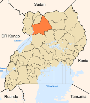
Gulu District
| map | |
|---|---|
 Location of Gulu |
|
| Basic data | |
| Capital | Gulu (Uganda) |
| Geographical center | 2 ° 46 ′ N , 32 ° 18 ′ E |
| North South expansion | 125 km |
| surface | 11,732 km² |
| population | 479,496 (as of 2002) |
| Population density | 40.9 inhabitants / km² |
| Deepest point | 760 m |
| The highest point | 1126 m |
| Time zone | UTC +3 |
| ISO 3166-2 | UG-304 |
Gulu is a district in northern Uganda with the capital of the same name, Gulu . It is one of three districts that together make up the historic homeland of the Acholi ethnic group , known as Acholiland . The population was 2002 479 496, of which live more than 90% from agriculture.
history
Gulu is a main combat area of the rebellious Lord's Resistance Army under Joseph Kony, who was born there .
Fort Patiko, founded by Samuel Baker in 1872 and later also used by Emin Pascha , is located 27 kilometers north of the capital .
climate
Gulu came in April 2000 from a long period of drought with annual rainfall between 0 and 27 mm. The decade 2000–2009, on the other hand, when summarizing the years 2003/2004, brought an annual average of 462.52 mm of rain. That was 21.47 mm less than in the period 1973–1978, where, despite the drought period of '73 / '74, 483.99 mm could be booked. The peak of 1977 with 1145.49 mm of rain was not reached again. The heaviest downpour since weather records began in 1957 fell on May 27, 2005 at 201.68 mm. The low points in 2008 and 2009 with 258.83 mm and 156.46 mm respectively indicate that in Gulu only irrigated agriculture can guarantee significant yields. The first quarter of the year took place in the years 2000-2009 mostly dry or slightly moistened, whereas the bulk of the precipitation times in the second, third or fourth quarter was achieved.
culture and education
The district has 234 elementary schools and 29 secondary schools. Gulu University is in Gulu , and there are three teacher seminars.
Probably the best-known Acholi, who comes from near Gulu, is Uganda's most famous writer Okot p'Bitek .
health
In October 2000 there was an outbreak of the Ebola virus in Gulu , in which around 200 of a little more than 400 infected people died. Gulu, like large parts of Africa, is also suffering from the AIDS epidemic. 11.9% of the residents are infected with the HI virus .
There are four hospitals, 28 health stations and 75 pharmacies.
structure
The district is located 332 km north of Kampala and consists of the four districts Kilak , Achwa , Omoro and Nwoya as well as the district of Gulu . These are further divided into 19 subdistricts, 121 parishes and 686 local parishes. Gulu has borders with seven other districts and with Sudan .
traffic
The northern line of the Uganda Railway runs through Gulu . The district has a total of 1015 km of roads.
Web links
- District Information Portal (English)