Mukono District
| map | |
|---|---|
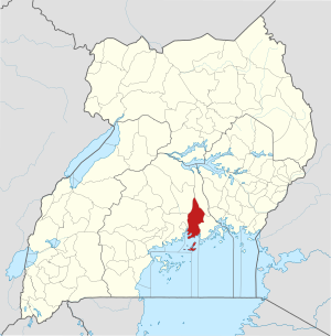
 Location of Mukono |
|
| Basic data | |
| Capital | Mukono |
| Geographical center | 0 ° 12 ′ S , 33 ° 5 ′ E |
| surface | 1,875.1 km² |
| population | 701,400 (as of 2020) |
| Population density | 374.1 inhabitants / km² |
| Time zone | UTC +3 |
| ISO 3166-2 | UG-108 |
Mukono is a district ( district ) in Central Uganda having about 701,400 residents. Like almost all districts of Uganda , it is named after its capital. It is located on Lake Victoria and also includes some islands in the lake.
The crop yields of agriculture in Mukono are low, which is why many farmers live in poverty and only eat once a day. The district used to produce 40% of the coffee in Uganda, but this has changed due to disease in the coffee plants. In cooperation with the export company Mukono Cafe Africa , coffee cultivation is to be promoted again.
The Mabira Forest is in Mukono .