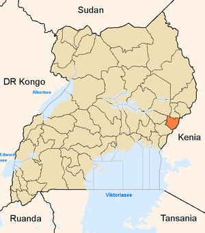
Mbale district
| map | |
|---|---|
 Location of Mbale |
|
| Basic data | |
| Capital | Mbale |
| Geographical center | 0 ° 58 ′ N , 34 ° 17 ′ E |
| North South expansion | 50 km |
| East-west expansion | 50 km |
| surface | 2,466.7 km² |
| population | 721,242 (as of 2002) |
| Population density | 292.4 inhabitants / km² |
| Time zone | UTC +3 |
| ISO 3166-2 | UG-209 |
Mbale is a district in eastern Uganda at the foot of Mount Elgon , which lies on the border with Kenya . The capital is the eponymous Mbale . The area of the district is 2,466.7 km².
The 2002 census found a population of 721,242 people, 92% of whom live in rural areas. This is why agriculture is the most important economic sector, with the main production goods coffee , beans , plantains , corn , onions , potatoes , carrots and sweet potatoes .
The population largely belongs to the Bamasaba and Bagisu , whose language Lugisu is an important lingua franca in Mbale.
Web links
- Government District information portal (English)