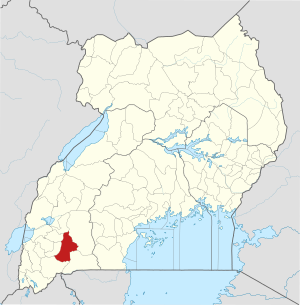
Mbarara district
| map | |
|---|---|
 Location of Mbarara |
|
| Basic data | |
| Capital | Mbarara |
| Geographical center | 0 ° 36 ′ S , 30 ° 36 ′ E |
| surface | 1,846.4 km² |
| population | 390,700 (as of 2020) |
| Population density | 211.6 inhabitants / km² |
| Time zone | UTC +3 |
| ISO 3166-2 | UG-410 |
Mbarara is a district ( district ) in Western Uganda with 390.700 inhabitants. Like almost all districts of Uganda , it is named after its capital - Mbarara . Mbarara is located in southwest Uganda on the border with Tanzania .
population
The inhabitants of the Mbarara district belong to various Bantu peoples, including the Ankole . Together with the neighboring districts of Bushenyi and Ntungamo , Mbarara belongs to the area of the former Ankole Kingdom .
climate
Climatically, Mbarara belongs to the dry tropics and over the decades has repeatedly experienced longer periods of drought. Summarizing the years 2003/2004 and 2005/2009, the annual rainfall for the decade 2000–2009 was only 335.25 mm. This is almost twice as much as in the period 1993–1999 when the years 1996/1997 are summarized, but compared to the period 1973–1978 it results in a slight decrease of 11.13 millimeters.
As a district of extremes, Mbarara knows the 100% humidity without precipitation (measured on January 21, 2001) as well as the destructive power of a torrential rain of 299.97 millimeters with only 55% humidity (measured on July 4, 1977). Because of the many phases of drought, the rainy seasons in Mbarara cannot be clearly determined. There is almost every month in a dry and in a wet version, but February and June are almost always free of precipitation or slightly damp.