Tite (Guinea-Bissau)
| Tite | ||
|---|---|---|
|
|
||
| Coordinates | 11 ° 47 ′ N , 15 ° 24 ′ W | |
| Basic data | ||
| Country | Guinea-Bissau | |
| Sul | ||
| region | Quinara | |
| ISO 3166-2 | GW-QU | |
| surface | 699.5 km² | |
| Residents | 14,862 (2009) | |
| density | 21.2 Ew. / km² | |
|
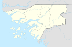
Location of the Tite sector in the Quinara administrative region
|
||
Tite is a small town in southwest Guinea-Bissau with 938 inhabitants (as of 2009). It is the seat of the sector of the same name with an area of almost 700 km² and 14,862 inhabitants (as of 2009), mainly Biafada with significant minorities from Mandinka and some Balanta , Fulbe and others. a.
Tite offers no special sights, apart from the surrounding nature in general.
history
The PAIGC guerrilla took up armed struggle in 1963 with an attack on the barracks of the Portuguese Armed Forces in Tite . The Portuguese colonial war began in Guinea-Bissau, where it lasted until 1974 and was particularly intense.
structure
The Tite sector consists of 63 localities. The most important are:
- Bissassema de Cima (1521 inhabitants in two districts)
- Bissilão Flaque Minde (726 inhabitants)
- Brandão (642 inhabitants)
- Enxude (568 inhabitants)
- Foia (788 inhabitants)
- Iusse (663 inhabitants)
- Nam Balanta (540 inhabitants)
- Porto Djabada (1277 inhabitants in two districts)
- Tite (938 inhabitants)
- the island of Ilheu de Mancebo (91 inhabitants)
Web links
Commons : Tite - collection of images, videos and audio files
Individual evidence
- ↑ a b Inhabitants by region, sector and town by gender, 2009 census (p. 16), PDF retrieval from the INE National Statistics Office of December 15, 2017
- ↑ Annual Statistical Report Guinea-Bissau 2015 (p. 10), PDF available from the National Statistics Office INE on December 15, 2017
- ↑ Joana Petrolho, Marta Rosa: À Descoberta da Guiné-Bissau . , Afectos com Letras / EU, Pombal 2015, ISBN 978-989-20-6252-5 , p. 87

