Tohmajoki
|
Tohmajoki Tochmajoki , Тохмайоки, Тохма, Tochma |
||
|
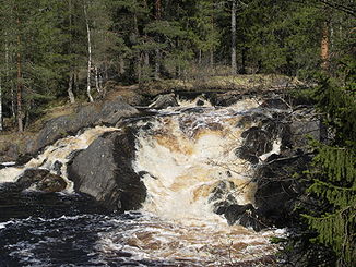
Rapids in Tohmajoki near Ruskeala |
||
| Data | ||
| Water code | FI : 02, RU : 01040300212102000010801 | |
| location |
North Karelia ( Finland ), Republic of Karelia ( Russia ) |
|
| River system | Neva | |
| Drain over | Neva → Baltic Sea | |
| source |
Tohmajärvi 62 ° 10 ′ 45 " N , 30 ° 25 ′ 11" E |
|
| Source height | 80.2 m | |
| muzzle | North of Sortawala in Lake Ladoga Coordinates: 61 ° 44 ′ 13 ″ N , 30 ° 45 ′ 5 ″ E 61 ° 44 ′ 13 ″ N , 30 ° 45 ′ 5 ″ E |
|
| Mouth height | 4 m | |
| Height difference | 76.2 m | |
| Bottom slope | 0.95 ‰ | |
| length | 80 km | |
| Catchment area | 1,594.6 km² | |
| Right tributaries | Kiteenjoki | |
| Flowing lakes | Rämeenjärvi , Pjalkjarwi , Ruokojarwi | |
| Communities | Helyla | |
The Tohmajoki ( Finnish ) or Tochmajoki , ( Russian Тохмайоки or short: Тохма, Tochma ) is a river in Finland and Russia . He springs from Lake Tohmajärvi in the same community of eastern Finnish landscape of North Karelia and flows in the Russian part of Karelia north of Sortavala in Ladoga , in turn, by the Neva River to the Baltic drained. It covers a distance of around 80 kilometers (including around 70 kilometers on the Russian side) and flows through the lakes Rämeenjärvi , Pjalkjarwi and Ruokojarwi . Shortly before it flows into Lake Ladoga, the Kiteenjoki meets the Tohmajoki when coming from the right. The catchment area of the Tohmajoki has a size of 1,594.6 km² and lies roughly equally on Finnish and Russian territory.
Web links
- Drainage Basin of the Baltic Sea. P. 224: "Kiteenjoki Tohmajoki river basins" (PDF file; 2.75 MB)
Individual evidence
- ↑ JÄRVIWIKI - Tohmajärvi (02.013.1.001)
- ↑ a b Finnish Ministry of the Environment - Suomen päävesistöalueet -taulukko
- ↑ a b Tohmajoki in the State Water Register of the Russian Federation (Russian)
