
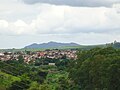
Três Pontas
| Três Pontas | ||
|---|---|---|
|
Coordinates: 21 ° 22 ′ S , 45 ° 31 ′ W Três Pontas on the map of Brazil
|
||
| Basic data | ||
| Country | Brazil | |
| State | Minas Gerais | |
| City foundation | 1768 | |
| Residents | 53,860 (2010) | |
| City insignia | ||
 |
 |
|
| Detailed data | ||
| surface | 689.421 km 2 | |
| Population density | 78.12 inhabitants / km 2 | |
| height | 905 m | |
| Time zone | UTC −3 | |
| City Presidency | Paulo Luís Rabello | |
| Website | ||
 |
||

Três Pontas is a city in the Brazilian state of Minas Gerais .
name of the city
The city is named after the special shape of a nearby mountain range with its three prominent peaks ( tres pontas port. = Three peaks), which served as a landmark for travelers and runaway slaves . These slaves founded the Quilombo do Cascalho settlement in the immediate vicinity of the mountain range , but it did not last long and was soon destroyed by the colonial rulers.
Geographical location
In the north the city borders on Campos Gerais and Santana da Vargem, in the south on Varginha, Elói Mendes and Paraguaçu, in the east on Nepomuceno and Carmo da Cachoeira and in the west on Campos Gerais. The city is located around 297 km from Belo Horizonte .
The two rivers Araras and Espera, which flow into the Furnas Dam, flow through the settlement area. The Rio Verde and Sapucaí rivers cross the southern border and also flow into the Furnas Dam, all of which belong to the catchment area of the Rio Grande .
history
The first inhabitants of the area were runaway slaves who founded two quilombos. As a result, there was hostility between the runaway and gold prospectors. Since no gold or other significant minerals were found in the area, the land was mainly used for agriculture. The mild climate particularly favored the cultivation of coffee. The official city founder is Captain Bento Ferreira de Brito, and the founding date was October 15, 1768. The settlement initially developed around a smaller chapel. This church was later rebuilt in colonial style: "Nossa Senhora d'Ajuda '" is now the largest church in the city.
Tres pontas

Nossa Senhora d'Ajuda

2012


In the course of growing Brazilian coffee exports, the city's economic life also took off in the 19th century. By expanding the roads to Rio de Janeiro and São Paulo , the city was connected to the two most important Brazilian export ports and economic centers. Today the city is one of the most important coffee production centers in Brazil.
Museums
The “Museu do Café” coffee museum in the Fazenda coffee factory in Pedra Negra, Rodovia Três Pontas / Varginha, shows antique devices for growing and processing coffee as well as written and pictorial documents. The manufactory is still in operation today.
The small historical museum Memorial Padre Victor is dedicated to the memory of the Catholic priest Padre Francisco de Paulo Victor (1827–1905). Padre Victor was born the son of a slave, was ordained a Catholic priest and worked for 53 years as a socially committed pastor in Três Pontas. Written documents and personal effects of Padre Victors are shown.
Personalities from Três Pontas
- José Costa Campos (1918–1997), Roman Catholic clergyman, Bishop of Divinópolis
- Milton Nascimento (born 1942), singer
- Wagner Tiso (* 1945), jazz musician and composer
Individual evidence
- ↑ Três Pontas - Atrativos ( page no longer available , search in web archives ) Info: The link was automatically marked as defective. Please check the link according to the instructions and then remove this notice. on Guiatrip.tur.br