Tracadie
| Tracadie | ||
|---|---|---|
 Panorama of Tracadie |
||
| Location in New Brunswick | ||
|
|
||
| State : |
|
|
| Province : | New Brunswick | |
| County: | Gloucester County | |
| Coordinates : | 47 ° 31 ′ N , 64 ° 55 ′ W | |
| Height : | 10 m | |
| Area : | 516.61 km² | |
| Residents : | 16,114 (as of 2016) | |
| Population density : | 31.2 inhabitants / km² | |
| Postal code : | E1X | |
| Area code : | +1 506 | |
| Foundation : | July 1, 2014 | |
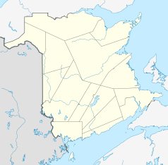
Tracadie is a Regional Municipality in southeast Gloucester County in the Canadian province of New Brunswick . It is located in the south of the Acadian Peninsula at the confluence of the Big Tracadie River and Little Tracadie River in the Gulf of Saint Lawrence . Tracadie covers an area of 516.61 km². In 2016, 16,114 people lived in Tracadie.
The administrative unit was established on July 1, 2016. It emerged from the merger of the town of Tracadie-Sheila, 18 Local Service Districts (LSDs) and parts of two other LSDs. The LSDs are: Benoit, Brantville, Gauvreau-Petit Tracadie, Upper Portage River (Haut-Rivière-du-Portage), Haut-Sheila, Leech, Pointe-à-Bouleau, Pont La-France, Sainte-Rose, Pont Landry, Rivière à la Truite, Portage River-Tracadie Beach, Saumarez, Saumarez Parish, Saint Irénée and Alderwood, Saint-Pons, Inkerman Parish and Val-Comeau. The two LSDs that contributed parts to the new administrative entity are Tabusintac and Inkerman Center.
Web links
Individual evidence
- ↑ Division No. 1, 2016 Census . Statistics Canada. Retrieved October 30, 2018.
