
Gloucester County (New Brunswick)
| Gloucester County | |
|---|---|
 Location of the region in New Brunswick
|
|
| Basic data | |
| Country | Canada |
| province |
New Brunswick
|
| Administrative headquarters | Bathurst |
| Coordinates : | 47 ° 43 ′ N , 64 ° 49 ′ W |
| Residents | 78,444 (as of 2016) |
| surface | 4,743.67 km² |
| Population density | 16.5 inhabitants / km² |
| Time zone : | Atlantic Standard Time ( UTC −4) Atlantic Daylight Time ( UTC −3, daylight saving time) |
Gloucester County is a county in the Canadian province of New Brunswick . The administrative seat is the city of Bathurst . The county has 78,444 inhabitants (as of 2016) and covers an area of 4743.67 km².
The county's economy is largely based on fishing, mining, and forestry. Tourism is becoming increasingly important.
The main geographical features are the Chaleur Bay , the Gulf of Saint Lawrence , the Pokemouche River (Rivière Pokemouche), Big Tracadie River (Grande Rivière Tracadie) and Nepisiguit River, and the islands of Île Pokesudie , Île Lamèque and Île Miscou .
Administrative division
cities and communes
There are 19 parishes in Gloucester County as of 2016.


| Surname | status | Area km 2 | Population 2016 |
|---|---|---|---|
| Bas-Caraquet | Village | 31.01 | 1305 |
| Bathurst | City | 92.04 | 11897 |
| Belledune | Village | 189.47 | 1417 |
| Beresford | Town | 19.41 | 4288 |
| Bertrand | Village | 57.44 | 1166 |
| Caraquet | Town | 68.35 | 4248 |
| Grande-Anse | Village | 24.33 | 899 |
| Lamèque | Town | 12.51 | 1285 |
| Le Goulet | Village | 5.49 | 793 |
| Maisonette | Village | 12.90 | 495 |
| Nigadoo | Village | 7.65 | 963 |
| Paquetville | Village | 9.26 | 720 |
| Petit Rocher | Village | 4.52 | 1897 |
| Pointe-Verte | Village | 13.76 | 886 |
| Saint-Isidore | Village | 22.94 | 764 |
| Saint-Léolin | Village | 19.73 | 647 |
| Sainte-Marie-Saint-Raphaël | Village | 15.90 | 879 |
| Shippagan | Town | 10.02 | 2580 |
| Tracadie | Regional Municipality | 516.61 | 16114 |
Indian reservations
There is a First Nations - Indian reservation (French: Premières nations, German: First Nations - all indigenous peoples in Canada).
| Surname | Area km 2 |
Population 2016 |
|---|---|---|
| Pabineau 11 | 4.92 | 134 |
Parishes
The county is divided into 9 parishes (as of 2016).
| Surname | Area km 2 |
Population 2016 |
|---|---|---|
| Allardville | 654.69 | 2032 |
| Bathurst | 1504.87 | 4797 |
| Beresford | 456.86 | 6248 |
| Caraquet | 109.97 | 1337 |
| Inkerman | 107.56 | 2366 |
| New Bandon | 359.11 | 1214 |
| Paquetville | 220.51 | 2329 |
| Saint-Isidore | 173.25 | 1361 |
| Shippagan | 208.08 | 4800 |
gallery

Panorama of Tracadie-Sheila
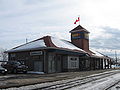
The train station at Bathurst

The Miscou Bridge

The church in Paquetville


Web links
Individual evidence
- ^ Census Profile, 2016 Census . Statistics Canada. Retrieved September 1, 2018.
- ↑ First Nations Reserves in New Brunswick ( page no longer available , search in web archives ) Info: The link was automatically marked as defective. Please check the link according to the instructions and then remove this notice.