
York County (New Brunswick)
| York County | |
|---|---|
 Location of the region in New Brunswick
|
|
| Basic data | |
| Country | Canada |
| province |
New Brunswick
|
| Administrative headquarters | Fredericton |
| Coordinates : | 45 ° 57 ′ N , 66 ° 39 ′ W |
| Residents | 97,238 (as of 2011) |
| surface | 8,136.7 km² |
| Population density | 12 inhabitants / km² |
| Time zone : | Atlantic Standard Time ( UTC −4) Atlantic Daylight Time ( UTC −3, daylight saving time) |
York County is a county in the Canadian province of New Brunswick . The administrative seat is the capital of New Brunswick, Fredericton . The county has 97,238 residents as of 2011.
The most important economic sectors are agriculture and forestry . The Saint John River divides the county in an east-west direction, and the Southwest Miramichi River flows in the northeast . The Trans-Canada Highway crosses the county, from west to east, in the southern part.
The historic, tourist settlement of Kings Landing from 1780 to 1910 is located near Prince William . The county is named after Frederick Augustus, Duke of York and Albany , the second son of the British King George III.
Municipalities and cities


York County consists of eight counties and the capital Fredericton (listed by population - 2011 Census).
| Surname | status | Area km 2 | Residents |
|---|---|---|---|
| Fredericton | city | 131.67 | 56,224 |
| New Maryland | Village | 21.24 | 4232 |
| McAdam | Village | 14.47 | 1284 |
| Nackawic | Town | 8.40 | 1049 |
| Stanley | Village | 17.34 | 419 |
| Harvey Station | Village | 2.46 | 363 |
| Canterbury | Village | 5.34 | 331 |
| Millville | Village | 12.16 | 307 |
| Meductic | Village | 5.57 | 270 |
Parishes
The county is divided into fourteen parishes (listed by population - 2011 Census).

| Surname | Area km 2 | Residents |
|---|---|---|
| Kingsclear Parish | 303.52 | 7391 |
| Douglas Parish | 1446.78 | 6081 |
| Saint Marys Parish | 753.12 | 4733 |
| Bright Parish | 404.17 | 3068 |
| New Maryland Parish | 375.78 | 2466 |
| Manners Sutton Parish | 525.74 | 1806 |
| Southampton Parish | 450.18 | 1538 |
| Queensbury Parish | 301.38 | 1272 |
| Stanley Parish | 1221.88 | 903 |
| Prince William Parish | 288.23 | 895 |
| Canterbury Parish | 557.22 | 609 |
| Dumfries Parish | 305.23 | 373 |
| North Lake Parish | 440.66 | 243 |
| McAdam Parish | 537.62 | 27 |
First Nations
There are two reserves of First Nations (listed by population - 2011 Census).
| Surname | status | Area km 2 | population |
|---|---|---|---|
| Devonian 30 | reserve | 2.73 | 864 |
| Kingsclear 6 | reserve | 3.75 | 490 |
gallery
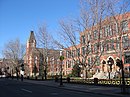
The historic Fredericton town house
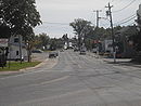
McAdam with the historic station building in the background

The world's largest ax by Nackawic

The Saint John River
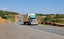
Former part of the Trans-Canada Highway - New Brunswick Highway 102

Paper mill in Nackawic


Web links
Individual evidence
- ↑ Kings Landing Historical Settlement. Kings Landing Historical Settlement
- ^ University of New Brunswick (UNB): University of New Brunswick
- ↑ Aboriginal Communities in Canada: Archive link ( Memento from March 1, 2007 in the Internet Archive )
- ^ First Nations Canada Reserves in New Brunswick: List of Indian reserves in Canada # Indian Reserves in New Brunswick