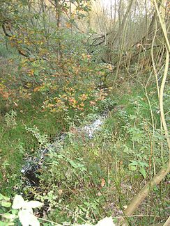
Trelder Bach
| Trelder Bach | ||
|
Trelder Bach |
||
| Data | ||
| location | Germany, Lower Saxony | |
| River system | Elbe | |
| Drain over | Sprötzer Bach → Este → Elbe → North Sea | |
| source | North of Trelde 53 ° 19 ′ 18 ″ N , 9 ° 47 ′ 42 ″ E |
|
| Source height | 57 m above sea level NN | |
| muzzle | southwest of Trelde from the right and north in the Sprötzer Bach Coordinates: 53 ° 18 ′ 34 " N , 9 ° 47 ′ 4" E 53 ° 18 ′ 34 " N , 9 ° 47 ′ 4" E |
|
| Mouth height | 42 m above sea level NN | |
| Height difference | 15 m | |
| Bottom slope | 8.8 ‰ | |
| length | 1.7 km | |
| Communities | Buchholz in the north heath | |
The Trelder Bach is a 1.7 km long brook in the Buchholz district of Trelde in the district of Harburg in Lower Saxony , which flows into the Sprötzer Bach from the right and north .
course
The Trelder Bach rises within the Buchholz district of Trelde in a wooded area on the Tannengrund road . It crosses under the federal highway 75 and flows through, in a south-westerly direction, first as a ditch on the Trift until the war memorial, through the village of Trelde. From the crossing under the Trelder Dorfstraße , the stream, clearly straightened, flows into a narrow, heavily overgrown meadow area, which is lined on both sides by houses, within the village of Trelde. At the southern soft patch of Trelde it flows into the Sprötzer Bach from the right and north .
Status
The Trelder Bach is critically loaded throughout its course (quality class II-III).
Traffic rules
Due to the intensive use of the Estonians by recreational sports and canoe rental companies, the Harburg district issued an ordinance in 2002 for the Estonians, their backwaters and the associated bank areas, which is intended to protect the habitat of plants and animals. Since then, driving and entering the Trelder Bach has been prohibited all year round.
