Tyson's Corner
| Tyson's Corner | |
|---|---|
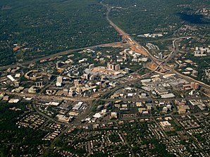
 Aerial view of Tysons Corner |
|
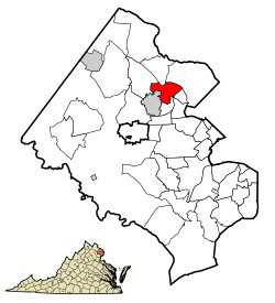
| Location of Tysons Corner in Fairfax County | |
| Basic data | |
| State : | United States |
| State : | Virginia |
| County : | Fairfax County |
| Coordinates : | 38 ° 55 ′ N , 77 ° 14 ′ W |
| Time zone : | Eastern ( UTC − 5 / −4 ) |
| Residents : | 19,627 (as of 2010) |
| Population density : | 1,545.4 inhabitants per km 2 |
| Area : | 12.7 km 2 (approx. 5 mi 2 ) of which 12.7 km 2 (approx. 5 mi 2 ) are land |
| Height : | 148 m |
| Postcodes : | 22102, 22182 |
| FIPS : | 51-79952 |
| GNIS ID : | 1496341 |
Tysons Corner is a place ( CDP ) in Fairfax County of the US state Virginia near Washington, DC It has about 20,000 inhabitants.
Tysons Corner is on Interstate 495 (Capital Beltway) . The surrounding towns are McLean , Pimmit Hills and Vienna .
economy
Tysons Corner is the economic center of Fairfax County , both as an office location and for shopping - a so-called Edge City . As a result, some major companies are headquartered in Tysons Corner, including:
- Alion Science and Technology
- Booz Allen Hamilton
- Capital One
- Freddie Mac
- Gannet
- Hilton Worldwide
- Iridium Communications Inc. (operator of the Iridium satellite communications system )
- Science Applications International Corporation
- Sunrise Senior Living
Web links
Commons : Tysons Corner - collection of images, videos and audio files
Wikivoyage: Tysons Corner - Travel Guide
Individual evidence
- ^ GNIS Detail - Tysons Corner. In: geonames.usgs.gov. Retrieved November 21, 2013 .
- ↑ Tysons Corner CDP Quick Facts from the US Census Bureau. (No longer available online.) In: quickfacts.census.gov. Archived from the original on December 2, 2013 ; Retrieved November 25, 2013 . Info: The archive link was inserted automatically and has not yet been checked. Please check the original and archive link according to the instructions and then remove this notice.
