Ubol Ratana Dam
| Ubol Ratana Dam | |||||
|---|---|---|---|---|---|
|
|||||
|
|
|||||
| Coordinates | 16 ° 46 '27 " N , 102 ° 37' 9" E | ||||
| Data on the structure | |||||
| Lock type: | Rock embankment dam | ||||
| Construction time: | 1964-1966 | ||||
| Height of the barrier structure : | 35 m | ||||
| Crown length: | 885 m | ||||
| Power plant output: | 25.2 MW | ||||
| Operator: | EGAT | ||||
| Data on the reservoir | |||||
| Altitude (at congestion destination ) | 179 m | ||||
| Water surface | 121 km² (?) | ||||
| Storage space | 2 263 600 000 m³ | ||||
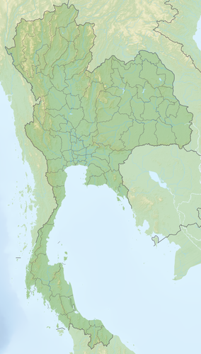
The Ubol Ratana Dam ( Thai : เขื่อน อุบลรัตน์ , pronunciation: [ kʰɯ̀an ʔùʔbon rát ] - "Ubon Rat Dam") was built between 1964 and 1966 in the Ubolratana District ( Amphoe ) , Khon Kaen Province ( Changwat ) in the northeast region of Thailand , the so-called Isan , established. Both the district and the dam are named after the Thai princess Ubol Ratana .
The dam is located at the breakthrough point of the Lam-Nam Phong (Phong River) through the Phu-Phan Mountains and is part of the Nam-Phong project of the Thai electricity company EGAT . The Lam-Nam Phong is a tributary of the Mae Nam Chi (Chi River) . The dam itself is laid out as a rock embankment dam .
In 1984 the plant was completely renovated to increase safety and efficiency. The dam is 35 meters high, 885 meters long and has a capacity of 2263.6 million cubic meters. The hydropower plant has a total output of 25.2 MW. It consists of three units with Kaplan turbines , each generating 8.4 MW.
Individual evidence
- ↑ World lake database ( Memento of the original from June 26, 2015 in the Internet Archive ) Info: The archive link was automatically inserted and has not yet been checked. Please check the original and archive link according to the instructions and then remove this notice.
- ^ Electricity Generating Authority of Thailand: Hydro Electric Dams in Northeastern Region

