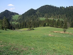
Ula (Pieninese)
| Ula | ||
|---|---|---|
|
Summit area in summer |
||
| height | 713 m npm | |
| location | Poland | |
| Mountains | Czorsztyner Pieninen , Pieninen , Carpathian Mountains | |
| Coordinates | 49 ° 25 '23 " N , 20 ° 20' 2" E | |
|
|
||
| Type | Rock peaks | |
| rock | limestone | |
The Ula is a mountain in the Polish Middle Pienines , a mountain range of the Pieninen , with a height of 713 meters. It is located in the Czorsztyn Pienines . The summit is about 250 meters above the Dunajec valley .
Location and surroundings
The Ula lies in the main ridge of the Pienines. To the southeast of the summit is the Dunajec Gorge , to the north is the Krośnica Valley .
tourism
The Ula is located in the Pieninen National Park . There is no marked hiking trail leading to the summit. As a strictly protected part of the national park, it is not accessible to tourists. However, it is clearly visible from the surroundings.
Web links
Commons : Ula (Pieniny) - collection of images, videos and audio files
literature
- Witold Henryk Paryski, Zofia Radwańska-Paryska: Wielka encyklopedia tatrzańska. Wydawnictwo Górskie, Poronin 2004, ISBN 83-7104-009-1 .
- Józef Nyka: Pieniny. Przewodnik. 9th edition. Trawers, Latchorzew 2006, ISBN 83-915859-4-8 .
- Pieniny polskie i słowackie. Mapa turystyczna 1:25 000. Agencja Wydawnicza "WiT" sc, Piwniczna 2008, ISBN 978-83-907671-3-0 .
panorama

View from the Spiš Pienines with the Niedzica castle and the Jezioro Czorsztyńskie reservoir (the Dunajec excursion boat on the left) in the foreground

