Pienines
| Pienines | |
|---|---|
|
View from the Sokolica with the Tatras in the background; Fog in the Dunajec breakthrough is typical of late autumn |
|
| Highest peak | Wysokie Skałki ( 1050 m npm ) |
| location | Poland |
| part of | Western Carpathians |
| Coordinates | 49 ° 25 ′ N , 20 ° 25 ′ E |
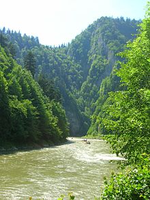
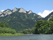
The Pieninen , formerly also called Kronenberg (Polish: Pieniny ) are a rugged mountain range northeast of the High Tatras in the Polish - Slovak border area on both sides of the Dunajec , which breaks through the mountains. In Poland they are located in the Lesser Poland Voivodeship in the Powiat Nowotarski District and the municipalities of Czorsztyn and Krościenko nad Dunajcem . In Slovakia they are located in the Prešovský kraj in eastern Slovakia . On August 17, 1932, Europe's first international landscape park was established here. Today there are two national parks , one Polish and one Slovak, with the larger one in Poland . The area is known for its natural beauties , such as the Trzy Korony , three limestone cliffs in the Dunajectal, the highest peak of which is 982 meters above sea level, and for the raft trips on the border river Dunajec, which runs through a gorge that is only about 100 meters wide here between up to 300 meter high rock walls flows. The highest mountain is the Wysokie Skałki at 1050 meters in the Little Pieninese . On the western edge of the Dunajec Gorge is the Červený Kláštor Monastery and on its eastern edge the spa towns of Szczawnica and Krościenko nad Dunajcem.
location
The Pieninen lies between the Polish Lesser Poland Voivodeship and Eastern Slovakia on the border river Dunajec . To the north of them lie the Gorce , the border forms the valley of the Krośnica , and south of the Spis Magura , the border is the Dunajec. To the west of the Pieninen lies the Podhale mountain range , the border is the Białka mountain river , and to the northeast the Beskydy Mountains , the border is the Grajcarek valley . The Pieninen have the character of a low mountain range . They form an arc about thirty kilometers long but only about two kilometers wide, which runs in an east-west direction.
geology
The Pienines are part of the approx. 600 kilometer long geological structure of the Pieninen rock belt made of limestone from the Jura geological age, which is named after them. Numerous geologists, u. a. Melchior Neumayr and Maurice Lugeon , puzzle abandoned. They are considered to be the most geologically interesting mountain range in the Carpathians. Their origins have not yet been scientifically clarified. According to one hypothesis, their rock was formed on an ocean floor, then at the beginning of the geological age the chalk was folded and piled up. In the Tertiary, they are said to have been folded twice, so that their complex structure emerged. The softer rock forms are said to have been removed by erosion, so that only the hard limestone cliffs and rocks on the northern edge of the Pienines, which are of volcanic origin, remained. The waters of the Pienines have dug fifteen deep ravines into the Pienines , of which the Wąwóz Szopczański and Wąwóz Homole are the most famous. Other karst phenomena, on the other hand, rarely occur in the Pienines.
Classification
The Pieninen can be divided from west to east as follows:
climate
In the Pieninen there is a special microclimate that distinguishes the mountain range from the surrounding regions. The climate is usually warmer, with big differences between the warm, well-sunlit southern slopes and the shady gorges of the mountain streams. Fog often occurs in late autumn and winter. The Pienines lie in the rain shadow of the surrounding higher mountains, the Tatras and the Beskids . The mountains are therefore dry and low in precipitation. Winds blow mainly from the west and northwest. Snow is usually from November to April. The foehn is by far weaker than in the Tatras.
nature
flora
The Pieninese have a very rich flora due to their microclimate. Half of all plant species occurring in Poland are found in the Pienines. On the one hand there are south-facing slopes that have an extremely high level of solar radiation, on the other hand some gorges are in the shade almost all day. Further factors that justify the biodiversity of the flora are in particular: - the calcareous soils - the proximity to the Tatra Mountains - the fact that the Pienines did not glaciate during the last ice ages - the slopes
fauna
It is believed that up to fifteen thousand animal species are at home in the Pienines. There are species of butterflies that cannot be found anywhere else in the world. Larger mammals, however, are rare. Insofar as one finds traces of bears and wolves in the Pienines, these are animals that have temporarily come to the Pienines from other ecosystems, especially the Tatra Mountains. The lynx, on the other hand, is native to the Pienines.
natural reserve
Polish National Park Pieniny
The national park on the Polish side, called Pieniński Park Narodowy in Polish , was founded in 1954 after the Pienins were placed under nature protection in Poland in 1930.
The Kronenberg is located near the Slovak town of Červený Kláštor ( Lower Swabia ) on the Polish side of the river. The breakthrough of the Dunajec can be admired from the highest of the five approximately 100 m high rock peaks.
Slovak National Park Pieniny
The Pieninen National Park , in Slovak Pieninský národný park , in northeastern Slovakia is the smallest Slovak national park at 21.25 square kilometers . It was founded in 1967 and is the heart of the Zamagurie (German about the area behind the Magura ).
The national park is located in the north of the Okres Kežmarok and in the northwest of the Okres Stará Ľubovňa on the state border with Poland, which is partly formed by the Dunajec .
Nature reserves
There are also five nature reserves in the Pienines:
- Biała Woda Nature Reserve
- Przełom Białki pod Krempachami Nature Reserve
- Wąwóz Homole Nature Reserve
- Wysokie Skałki Nature Reserve
- Zaskalskie-Bodnarówka nature reserve
tourism
Hiking trails
The valleys in the Pienen are densely populated and developed for tourism. There are numerous marked hiking trails:
- ▬ the blue-marked ridge path of Czorsztyn over the Czorsztyner Pieninen and the mountain pass Przełęcz Szopka to the summit of Trzy Korony , Ostry Wierch , Zamkowa Góra in the Pieninki and down to the river Dunajec for crossing Nowy Przewóz to Szczawnica where the Pieninenweg in Dunajec begins.
- ▬ a yellow-marked hiking trail from Krościenko nad Dunajcem to the summit Bajków Groń and the Przełęcz Szopka mountain pass, the Wąwóz Szopczański gorge to the Three Crowns Refugein Sromowce Niżne on Dunajec .
- ▬ a green hiking trail from Krościenko nad Dunajcem via the Kapliczka św chapel . Kingi on the Przełęcz Sosnów mountain pass.
- ▬ a red marked hiking trail from Sromowce Wyżne to the Przełęcz Trzy Kopce mountain pass.
- ▬ a green marked hiking trail from the Three Crowns Hut to Wyżni Łazek and Polana Kosarzyska .
- ▬ a red marked hiking trail from the Orlica hut to the Pieninenweg to the Červený Kláštor monastery.
- ▬ a green hiking trail from Krościenko nad Dunajcem to the Przełęcz pod Czertezikiem mountain pass.
- ▬ a yellow marked hiking trail from Szczawnica , Palenica to Szafranówka .
- ▬ a yellow hiking trail from Szlachtowa , Huściawa to Veľký Lipník .
- ▬ a green hiking trail from Jaworki across the Wąwóz Homole gorgeto the Polana pod Wysoką alpine pastureto Stráňany .
Mountain huts
There are three refuges in the Pienen:
- Durbaszka hut in the Little Pieninese
- Orlica hut between the Kleine Pienen and the Mittlere Pieninen
- Drei-Kronen-Hut in the Middle Pieninen
Ski areas
In the Pieninen, specifically in the Kleine Pieninen, there are two larger ski areas:
literature
- Witold Henryk Paryski, Zofia Radwańska-Paryska: Wielka encyklopedia tatrzańska. Wydawnictwo Górskie, Poronin 2004, ISBN 83-7104-009-1 .
- Józef Nyka: Pieniny. Przewodnik. 9th edition. Trawers, Latchorzew 2006, ISBN 83-915859-4-8 .
- Pieniny polskie i słowackie. Mapa turystyczna 1:25 000. Agencja Wydawnicza "WiT" sc, Piwniczna 2008, ISBN 978-83-907671-3-0 .
- Ivan Voluščuk: Pieninský Národný Park . AKCENT press service, 1992, ISBN 80-900447-5-1
Web links
- Informative site about the Pienines
- Pieniński Park Narodowy - a Polish site about the national park, also in English
- Pieniny on PieninyPortal.com - complex and important information, rafting on Dunajec, tour guide and maps
- Pieniny on Travelia.sk


