Lower Auwiesengraben
| Lower Auwiesengraben | ||
|
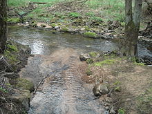
The Untere Auwiesengraben crosses a dirt road |
||
| Data | ||
| location |
Spessart
|
|
| River system | Rhine | |
| Drain over | Lohr → Main → Rhine → North Sea | |
| source | southeast of the Rote Mühle 50 ° 1 ′ 5 ″ N , 9 ° 32 ′ 51 ″ E |
|
| Source height | 170 m above sea level NHN | |
| muzzle | in the left arm of the Lohr coordinates: 50 ° 0 ′ 43 ″ N , 9 ° 33 ′ 23 ″ E 50 ° 0 ′ 43 ″ N , 9 ° 33 ′ 23 ″ E |
|
| Mouth height | 164 m above sea level NHN | |
| Height difference | 6 m | |
| Bottom slope | 5.5 ‰ | |
| length | 1.1 km | |
The Untere Auwiesengraben is a left tributary of the Lohr in the urban area of Lohr am Main in the Bavarian Spessart .
geography
course
The Untere Auwiesengraben is being built southeast of the Rote Mühle . It runs along federal highway 276 to the southeast. After about 900 m, a part of the Lehngrundbach is fed to it on rainy days . Then the Untere Auwiesengraben flows into the left arm of the Lohr near the Steinthalerhof .
Lohr river system
See also
Web links
Commons : Unterer Auwiesengraben - Collection of images, videos and audio files
Individual evidence

The Untere Auwiesengraben (in front) flows into the left arm of the Lohr
