Unterkaka
|
Unterkaka
community Meineweh
|
|
|---|---|
| Coordinates: 51 ° 5 ′ 26 ″ N , 11 ° 58 ′ 4 ″ E | |
| Height : | 247 m |
| Area : | 7.07 km² |
| Residents : | 290 (December 31, 2008) |
| Population density : | 41 inhabitants / km² |
| Incorporation : | January 1, 2010 |
| Incorporated into: | Anhalt South |
| Postal code : | 06721 |
| Area code : | 034422 |
|
Location of Unterkaka in Meineweh
|
|
|
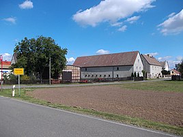
Unterkaka from the southwest
|
|
Unterkaka is a district of the community of Meineweh in the Burgenland district in Saxony-Anhalt .
The place is on the B 180 13 km west of Zeitz . Unterkaka was the name of the community, which consisted of the places Unterkaka, Oberkaka, Zellschen and Schleinitz. Since the federal highway 9 runs in the immediate vicinity, entertain u. a. the companies Kaufland and Hagebau have a central warehouse in Unterkaka.
history
The place was first mentioned in 976 as Villa Chaca , which was donated to the Zeitz diocese by Emperor Otto II .
On July 1, 1950, the previously independent municipality Schleinitz was incorporated. On July 1, 1932, the parish of Korseburg was incorporated into Schleinitz.
On January 1, 2010, the previously independent communities of Unterkaka, Meineweh and Pretzsch merged to form the new community of Anhalt Süd, which was later renamed Meineweh .
badges and flags
The coat of arms of Unterkaka was approved on January 28, 2000 by the regional council of Halle (Saale).
Blazon : “In silver, three natural red roses in a wedge shape to the left on a curved, leafy green tendril; in front a red bordered black flank. "
The flag of the former municipality of Unterkaka shows the colors of Unterkaka: red and white.


