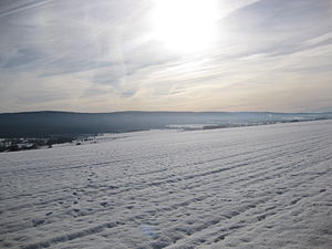
Usar head
| Usar head | ||
|---|---|---|
|
Usarkopf in the main ridge of the Idarwald |
||
| height | 725.4 m above sea level NN | |
| location | Districts of Bernkastel-Wittlich and Birkenfeld ; Rhineland-Palatinate , Germany | |
| Mountains | Idarwald ( Hunsrück ) | |
| Coordinates | 49 ° 46 '57 " N , 7 ° 8' 15" E | |
|
|
||
The Usarkopf is a 725.4 m above sea level. NN high elevation of the Idarwald ( Hunsrück ) in the districts of Bernkastel-Wittlich and Birkenfeld in Rhineland-Palatinate .
It is located south of Morbach (Bernkastel-Wittlich district) on the boundary with Wirschweiler (Birkenfeld district).
Individual evidence
- ↑ a b Map service of the landscape information system of the Rhineland-Palatinate Nature Conservation Administration (LANIS map) ( notes )

