Usa (Volga)
|
Ussa Уса |
||
| Data | ||
| Water code | RU : 11010000512112100005465 | |
| location | Ulyanovsk Oblast , Samara Oblast ( Russia ) | |
| River system | Volga | |
| Drain over | Volga → Caspian Sea | |
| source | 30 km northwest of Syzran 53 ° 25 ′ 4 ″ N , 48 ° 10 ′ 36 ″ E |
|
| muzzle | near Schigony in the Kuibyshev reservoir Coordinates: 53 ° 19 ′ 27 ″ N , 48 ° 46 ′ 19 ″ E 53 ° 19 ′ 27 ″ N , 48 ° 46 ′ 19 ″ E
|
|
| length | 76 km | |
| Catchment area | 2240 km² | |
| Outflow location: 23 km above the mouth |
NNQ MQ HHQ |
600 l / s 16.1 m³ / s 1250 m³ / s |
| Left tributaries | coca | |
| Reservoirs flowed through | Kuibyshev reservoir | |
| Navigable | on the lower reaches | |
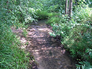
The Ussa ( Russian Уса ) is a 76 km long right tributary of the Volga in the European part of Russia .
description
The Ussa rises between the villages of Smolkino and Krasnoye Polje in the far west of Samara Oblast , not far from the border with Ulyanovsk Oblast . From there it flows in a northerly direction, where it crosses the border after just a few kilometers. In the area of Ulyanovsk Oblast, the Ussa now mostly flows in an easterly direction. It takes up the coca and after a short distance reaches Samara again.
Here it turns to the southeast and south and flows through the agriculturally intensively used west of Samara Oblast. Between Gubino and Muranka the river finally flows into a branch of the Kuibyshev reservoir , to which the Volga is dammed here.
The Ussa is navigable on its lower reaches. The water of the Ussa is used commercially and in agriculture and is moderately polluted.
Individual evidence
- ↑ a b c d Article Ussa (Volga) in the Great Soviet Encyclopedia (BSE) , 3rd edition 1969–1978 (Russian)
- ↑ a b Ussa in the State Water Register of the Russian Federation (Russian)
- ↑ Hydrochemical values of the Ussa on smallrivers.narod.ru (Russian)
